Yesterday, Kristin and I set off on a new exciting research adventure back to my old stomping grounds: Denali National Park and Preserve (DNP), Alaska. 2015 was the first in eight years that I had not returned to the wonderful town of Talkeetna, the hub of access to glaciers and mountains in DNP. Talkeetna is one of my favorite towns in the country and for several years it turned into a summer home base for me. Amazing people, wonderful businesses, caring community, all within walking distance of each other and a backdrop of the Alaska Mountain Range. Who could ask for more in an Alaska town?!
the highest mountain in DNP also happens to be the highest in North America at 20310 feet above sea level. This peak was formerly known by U.S. citizens as Mount McKinley but its name was recently reverted back to one originally provided by natives of the area: “Denali” or “The Great One.” It seems fitting that a place which is still wild, remote, and rugged by anyone’s classification, bears its original name. Denali creates a trifecta view with two other large peaks in the area: Foraker (17,400 feet above sea level) and Hunter (14,573 feet above sea level). Native stories tell of Denali being the Father, Foraker being the mother, and Hunter being the child. These three peaks create the ultimate backdrop to the town of Talkeetna when viewed across nearby Susitna River.
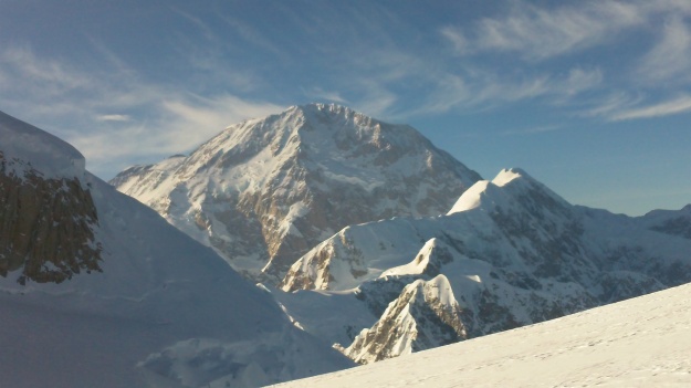
“The Great One” (Denali) viewed from Middle Hunter Peak on the flanks of Mount Hunter (photo by Karl Kreutz, 2013)
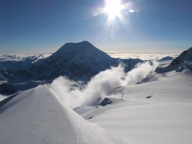
Mount Foraker from the summit of the Middle Peak on Mount Hunter in 2013. Note the snow covered valley on the right side of this photo is the ice divide that we collected two surface to bedrock ice cores from in 2013. You can see some ski tracks in the photo where we collected ground penetrating radar ice depth measurements.
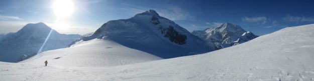
The big three: Mount Foraker on the left, Mount Hunter in the middle, and Denali on the right in the back. Just in the sun near the shadow of Hunter you can see a dark area in the snow. That was the ice core drill site in 2013.
The first reported successful ascent of Denali was in 1913 by a group up the Muldrow and Harper Glaciers located on the North side of Denali. In 1951 Bradford Washburn and his team forged their way up the Kahiltna Glacier to the summit of Denali. Today, more than 1000 climbers per year attempt to climb Denali via the West Buttress along the Kahiltna Glacier, the same route that Washburn’s team climbed over 70 years ago. Approximately 50% of those climbers are successful with the remaining climbers being turned around prior to reaching the summit due to a number of reasons. Climbing the West Buttress is an enormous endeavor: 13,000 feet of elevation gain along 18 miles of crevasse-covered glaciers, steep, and icy slopes over the course of 2-3 weeks in sub-arctic conditions can challenge the most proficient climbers. Add 50-100 pounds of extra research gear on top of what climbers typically bring with them, and our team has our work cut out for us.
The mountain is big, hazards are real, weather and temperatures can be extreme, and climbing at elevation is just down-right exhausting, challenging, and even dangerous due to potential altitude related illnesses. SO, in front of our primary research goals for this season that I list below, we have a fourth goal which is ultimately the most important so I list it first:
Our goals this year are to:
1) Maintain the health, safety, and well-being of our team.
2) Install a USGS survey marker on bedrock at or near 14,000 feet above sea level which will be used for repeat elevation surveys of Denali over the next several years to estimate tectonic uplift rates;
3) Measure the ice thickness on the summit of Denali at 20,310 feet above sea level, using Ground-Penetrating Radar;
4) Collect snow samples along an elevation transect (some snow at high elevation and some at lower elevation) on the mountain to compare their chemistry.
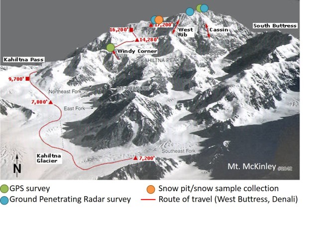
Proposed climbing route and research sites for this years effort on Denali
My colleagues and I have written lots about our prior research efforts in DNP on previous BLOG’s so if you are interested you can bone up here. We also have several papers published on the Kahiltna Glacier and other regions within DNP that are listed here. This year’s research effort is funded by two primary sources:
The first source is from the U.S. Geological Survey to our team leader, Blaine Horner, who works for Compass Data Inc. Their funding is provided to install the USGS monument and radar survey the summit of Denali. The second source of funding is from Dartmouth College to continue the snow chemistry research and other associated projects as part of our long term ice core research effort within DNP. The teams for each project decided to team up in effort to minimize impact on the mountain (i.e. fewer climbers) and also to combine resources. As always, a hearty thank you goes out to the many individuals working for the park, air service providers, and within the town of Talkeetna who continue to make our research a possibility. The summit team for this project includes Blaine Horner, Kristin Schild, Patrick Saylor and myself. Bio’s for Blaine and Kristin are below. Bio’s for Patrick and I can be found in our Eclipse research (prior blog posts).
Blaine Horner: Blaine is an account executive for CompassData Inc. and he pieced the proposal together to install the GPS monument and collect radar data at the summit of Denali. Blaine has a pretty extensive outdoor history which includes ski patrolling, surveying, and search and rescue as a ranger for Denali National Park. In 2015 his team successfully resurveyed the summit elevation of Denali which had not been completed in recent time. Prior elevations were listed as 20,320 feet above sea level but Blaine’s more recent survey with current technology revealed an elevation of 20,310 feet, 10 feet lower than previously thought. Find more about Blaine’s 2015 effort here. Thanks for the initiative in pursuing this great project and for the invite Blaine!
Kristin Schild: Kristin is in the final year of her PhD at Dartmouth College within the Earth Sciences Department. Her research focuses on understanding subglacial water controls on tidewater outlet glaciers in Greenland and Svalbard. She has participated in over a twenty field seasons in places including Svalbard, Greenland, Alaska, and Antarctica and it’s probably her favorite part of the job. She has also spent a ton of time working with ground-penetrating radar, GPS, meteorological stations, and oceanography instrumentation as well as using remote sensing data from satellites to study glaciers, oceans, and landforms. In her spare time Kristin is also on the New England K9 Search and Rescue Team with our Coonhound, Kinley and she volunteers as a diving instructor for Dartmouth and local 8-12th grade students in the Upper Valley of New Hampshire. Oh yeah, in all her free time she ALSO is a substitute science teacher for Indian River Middle School in Canaan, NH! She is a busy woman so we are psyched to have her along!
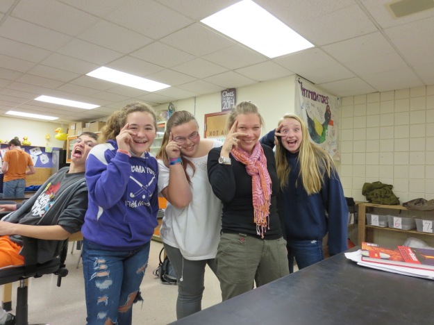
Kristin (second from the right) in one of her many elements with some of the students she teaches science to at Indian River Middle School!
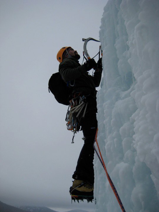
Patrick Saylor: Just a photo for Patrick considering he already has a bio a couple posts back!
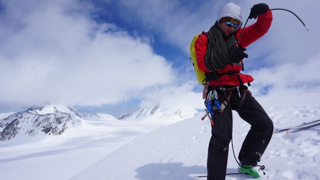
Seth Campbell: Not much reason to have a bio of me here so, also just a photo!