
It’s been quite some time since I’ve blogged about my on-goings. Since climbing Denali in May of 2016 with Kristin, Blaine, and Patrick, I’ve taught a field geology-geophysics course for UMaine in New Hampshire and Vermont which included several lake surveys with radar by canoe; moved to Seattle for 1-2 years to work with an amazing group of scientists at the University of Washington Department of Earth and Space Sciences; had many fishing, climbing, and other outdoor weekend adventures in Olympic National Park, Mt Rainier National Park, and the Cascades; been to two weddings (one of which I performed the ceremony of for my best friend, Jacob, and his amazing wife Jesse!); returned to the Eastern Alaska Range in September for a short two day field season of GPS measurements; been to Antarctica conducting research on two different projects I’m involved in; and climbed in New Hampshire for a few days of relaxation after my winter field work. Now I’m back in Seattle preparing for my next field season in Eastern Alaska with the UMaine and Dartmouth crew.
I missed Thanksgiving, Christmas, and New Years away from my wonderful family. We have very sadly lost some friends and family in the world recently. But, I also have some wonderful memories from the past nine months. Instead of a long blog today, I thought a bunch of photos/videos that reflect where I’ve traveled, outdoor adventures I’ve pursued, the friends I’ve spent time with, and some science I’ve completed, would be more fun for people to look at. Enjoy!

Relaxing with Kinley in the hammock after a spring and early summer full of field work!

Getting ready to conduct a radar survey of lake bottom stratigraphy with my long time mentor, Steve Arcone, and a student from UMaine. Perfect day to be on the water!

Steve doing what he is the master of (GPR)! Tom and I getting ready to paddle.

A radar profile collected across a lake in New Hampshire showing water depth, layered sediments, and bedrock or till under the sediments. The sediments re probably made up of fine grained sands and silts deposited since the last glaciers retreated in this area over 12000 years ago.

Jeep loaded down with clothes, bicycle, books, and outdoor gear, ready for the move from New Hampshire to Seattle!

Some of my best friends that we were able to visit during our cross country road trip! Jacob (left), Kristin, and Jesse (right).

Kristin and I were also able to visit her best friend, Abbey, for an evening during the road trip!

Kinley (right) has a long lost brother, Abbey’s puppy (on the left)!

Kristin’s prior office mate from Dartmouth, Lee, just happened to be in Bozeman, Montana when we were driving across country! Found a beautiful hike to spend an afternoon with her. This was also a great excuse to get Kinley out to stretch her legs!

Arrived in Seattle, ready to roll. BUT, work doesn’t mean I can’t get out and play in the mountains on the weekend! Here, my good friend Brad tops out on a climb we completed in the Cascades. Brad and I have been on five field research seasons together so far and have another planned this spring!
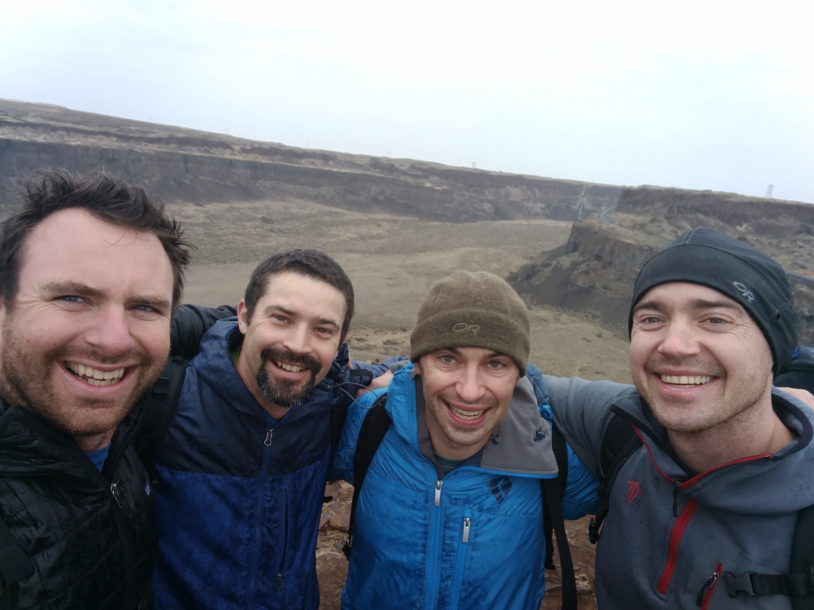
Friends from Maine! Scott Higgins, Tom and Dave Cassidy paid me a visit in Seattle to climb some in the Cascades. Too bad the weather was not great but we still had fun.

Well… when its raining we find something else to do…. Like go check out Leavenworth during Octoberfest!

Climbing at Washington Pass with some Juneau Icefield Research Program friends: Scott and Isabel!

Washington Pass is a pretty amazing area!
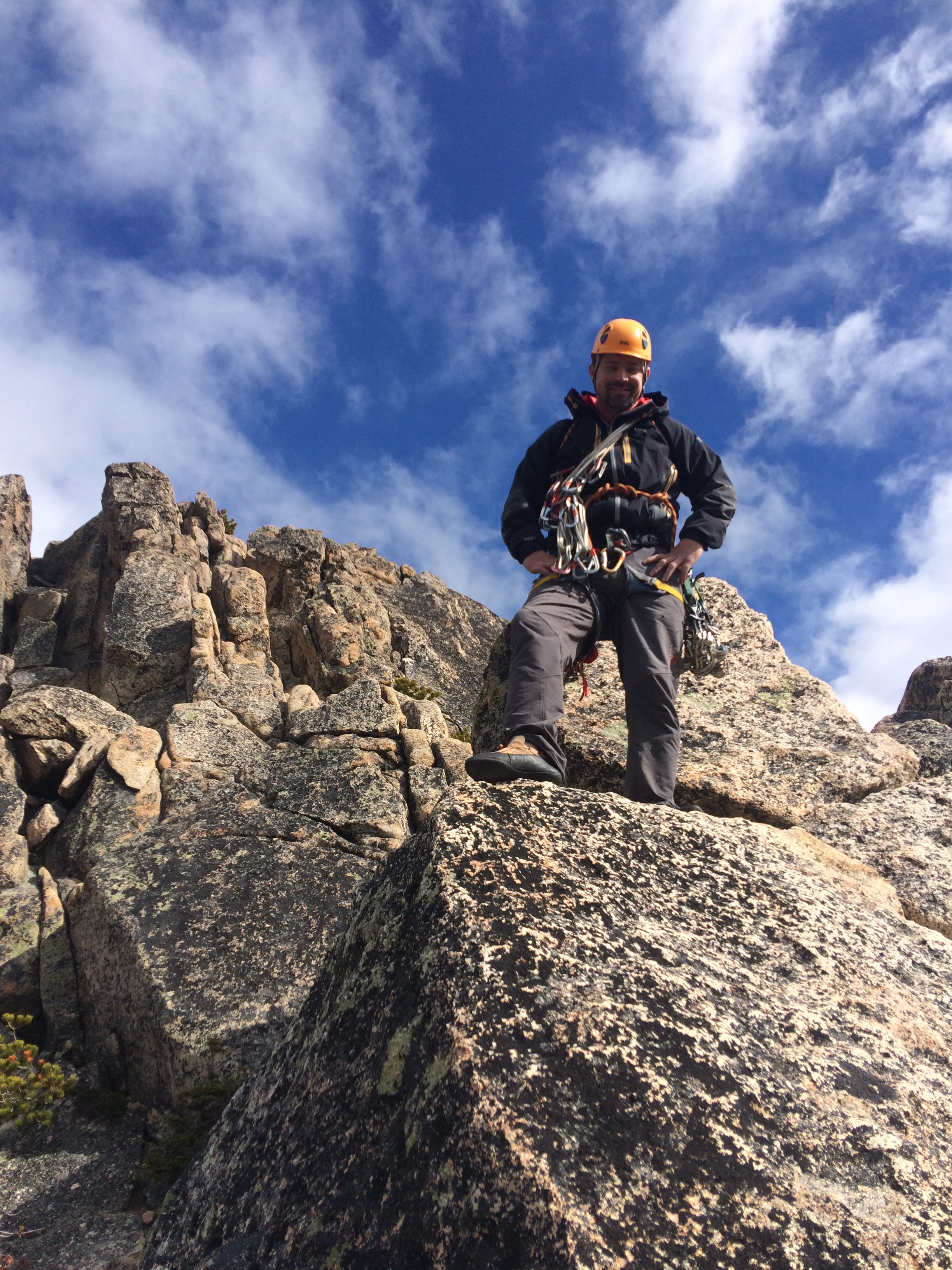
Classic granite on an amazing fall day in the Cascades!

Ok…. so I have actually done LOTS of work this year as well… in fact, about 6 months of time away from home on field work. This is a map of McMurdo Ice Shelf in Antarctica. Last year we collected about 1300 km of radar in the grid on this map to look and the internal structure of the shelf. The next several photos are figures from the radar data we collected that I have finally processed.

This radar profile was collected from the sea ice onto McMurdo Ice Shelf. You can see lots of cool internal features but too much to explain fully here. feel free to email me though if you have questions about the profile!

Another cool radar profile with TON’s of cool glacier-ocean-ice flow features occurring here.

And another….. this profile crossed the convergence of two glaciers basically! Pretty cool to see where the ice mass from one glacier ends and the ice mass of another glacier begins!

Fractures in the bottom of the ice shelf show up as these hyperbolas.

Another profile taken across the transition from sea ice onto the ice shelf. Only this profile shows a bunch of folds in the ice from land that the ice is obliquely running into.

a to a’ on this photo (courtesy of Ben Roth) shows about where the last radar profile was collected. You can also see the folds on the surface as the ice shelf moves towards the open ocean but also pins up against hut Point Peninsula (which causes the ice to fold).

Ht Point Peninsula is an interesting location. This is where vehicles from McMurdo and Scott Base access McMurdo Ice Shelf where the runways are located for transporting people to and from the ice. The folding at this location is worrisome to the folks in charge of McMurdo operations so we are studying the neighboring hillside to see 1) how much ice is there and 2) how fast that ice is moving down hill. We are doing this to determine if we may be able to put a road on the hillside that accesses the ice shelf further up-glacier and bypasses the major folding of the ice shelf in this area. This figure shows ice depths on the hill side and ice flow velocities measured using very high precision GPS survey instruments.

I am also modeling the ice flow on the hillside. This is a block model of the hill based on ice thicknesses determined by radar and surface topography determined from a high resolution digital elevation model. The basics: my numerical model matches observations pretty well. BUT lots more to add to the model!

Collecting GPS information for ice flow velocities (shown a couple photos back) on the Hut Point hillside.

Colleagues helping me collect radar ice thickness measurements on the Hut Point Hillside. Thanks John, Trevor, and Perry! (notice we are roped up to keep us safe from any potential crevasses buried under the snowpack). Also notice Mount Erebus and Castle Rock in the background, two iconic features of Ross Island.

I finished my first Antarctic project on time… so, with some evenings of down time, I was able to take a rec trip to see some of the other local sights. Here is an iceberg frozen into the sea ice.
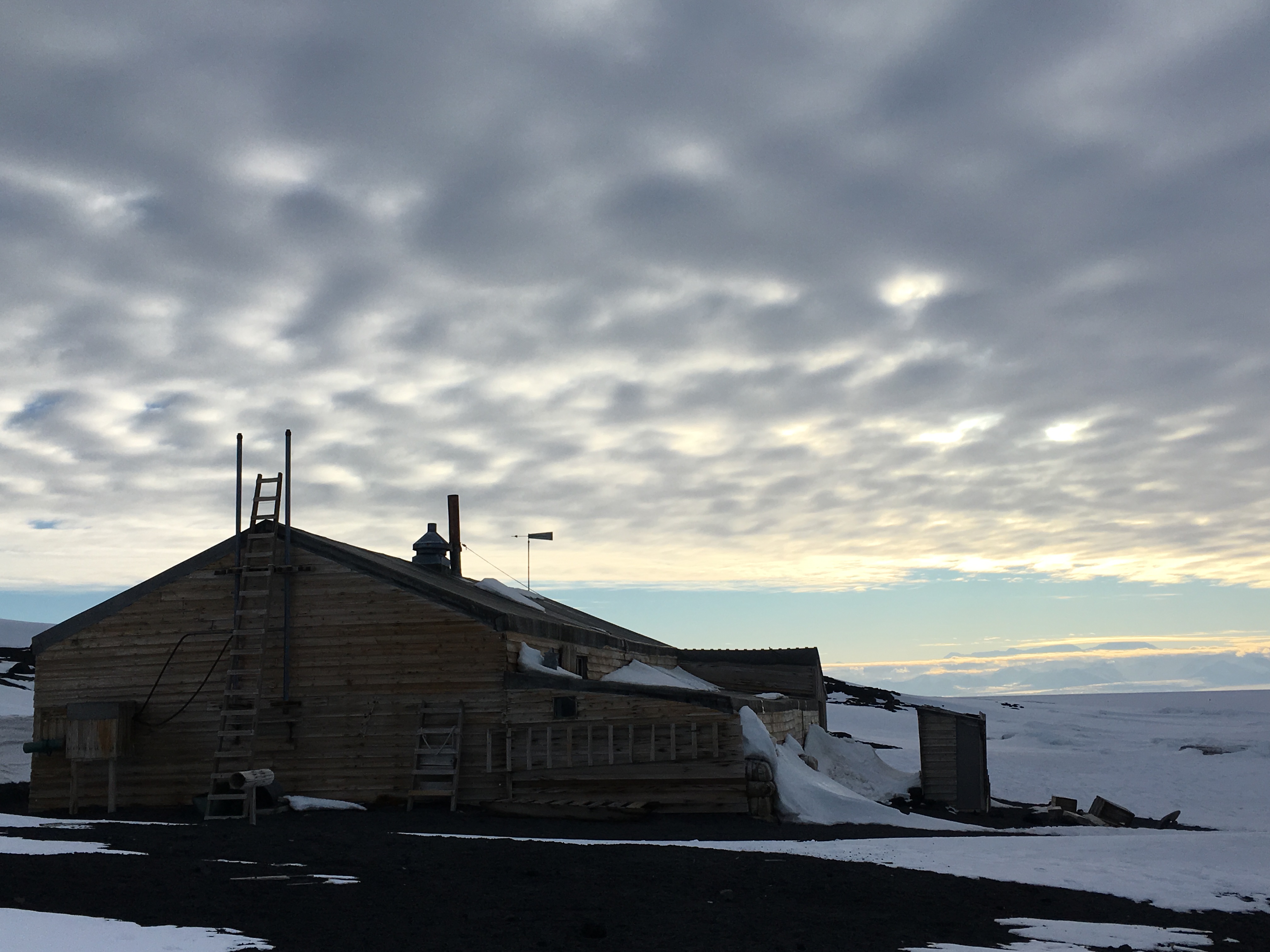
Scotts Hut at Cape Evans which was used by part of Sir Robert Falcon Scott’s team between 1911 and 1913. Pretty amazing history here and well worth researching yourselves. Recommended reads include: Scotts Journals which chronicle his attempt to reach the pole, right up to his death at the very end; and “Endurance: Skackletons Incredible Voyage” which chronicles Shackletons attempt to reach the pole but getting stuck in pack ice instead!

Just some cool wooden crates by Scotts Hut!

Zoom of a little guy wandering around on the sea ice while we were on our way back from Cape Evans! Amazing little guy!
A video of Mr. Penguin paralleling the road. We didn’t want to disturb him with the vehicle so we stopped, and let him walk on by as he was travelling to who knows where!
A video taken from Observation Hill which is situated in between Scott Base and McMurdo Station. In the video you can see Mount Erebus, Castle Rock, McMurdo Station, the sea ice, the ice shelf-sea ice transition, the Royal Society Range across the sea ice which is located in the dry valleys, White and Black Island, and the McMurdo Ice Shelf. Amazing day up there with colleagues, Ryan, Zoe, and Fegy!
A video panning around while surveying the Hut Point Hillside looking towards the significant folds of ice at the ice shelf sea ice transition.

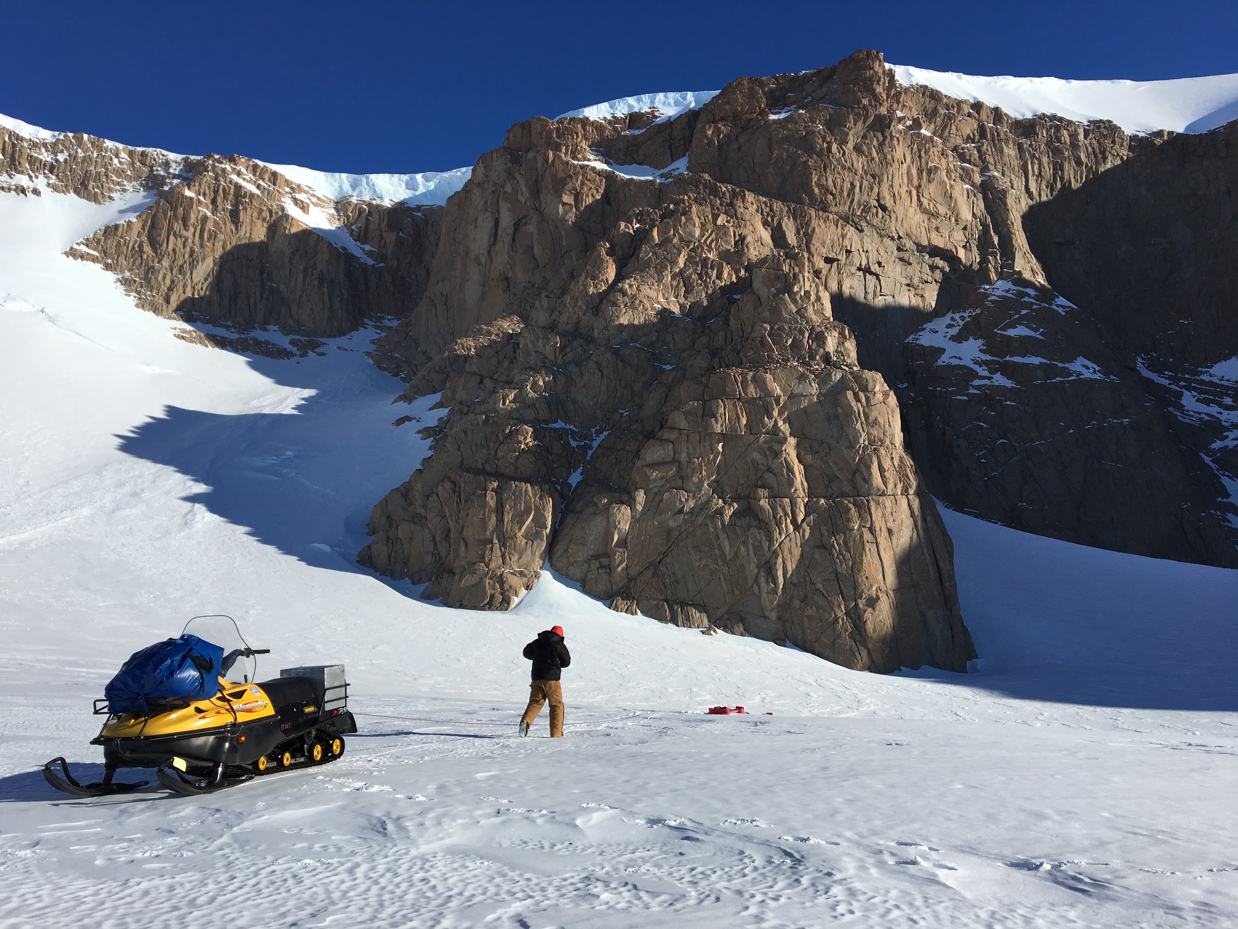
On to the next project! Ohio Range, or what we called the “No-Fly-O” Range because it is a notoriously difficult place to reach. About 300 miles from South Pole in a region where weather converges from the East Antarctic Plateau and storms coming from the coast across West Antarctica. BUT, our pilots and NSF support folks did an amazing job this year and we got out to our study site quickly! The arrows are velocities measured using GPS stakes installed last year and remeasured this year.
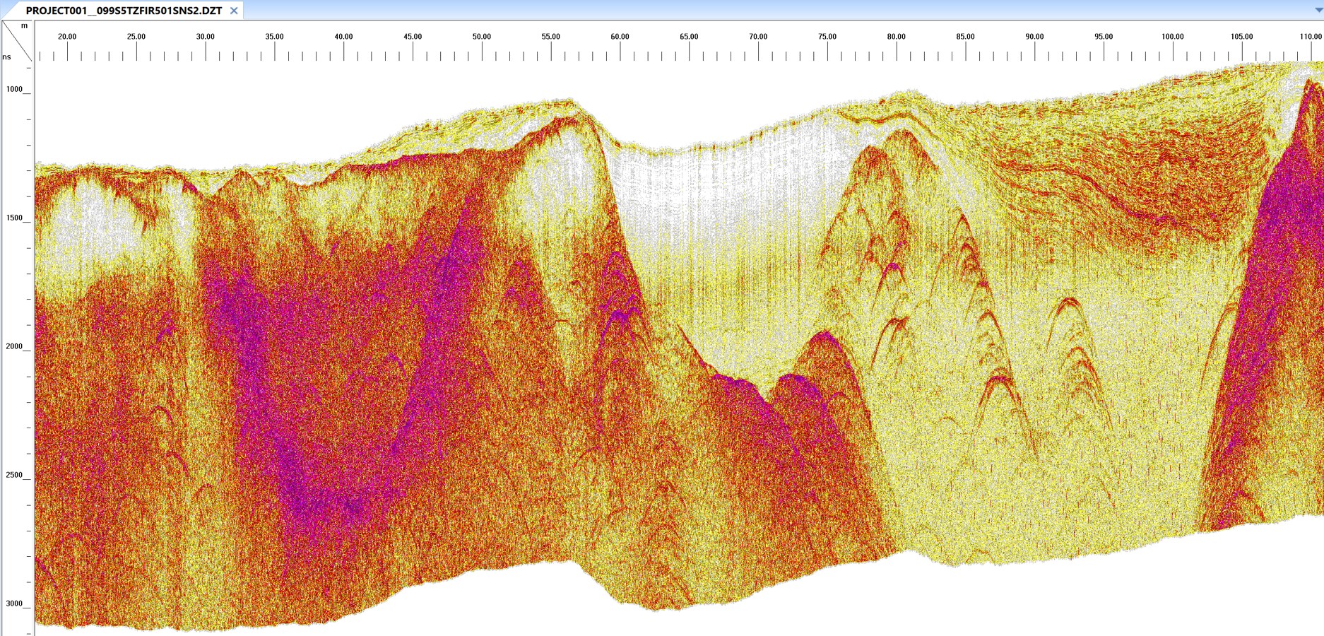
A really cool radar profile showing bedrock below ice, as well as ice rich till and contacts between firn and blue ice…. yep… lots going on so I will avoid describing all the details… just take if from me that this profile is really cool!
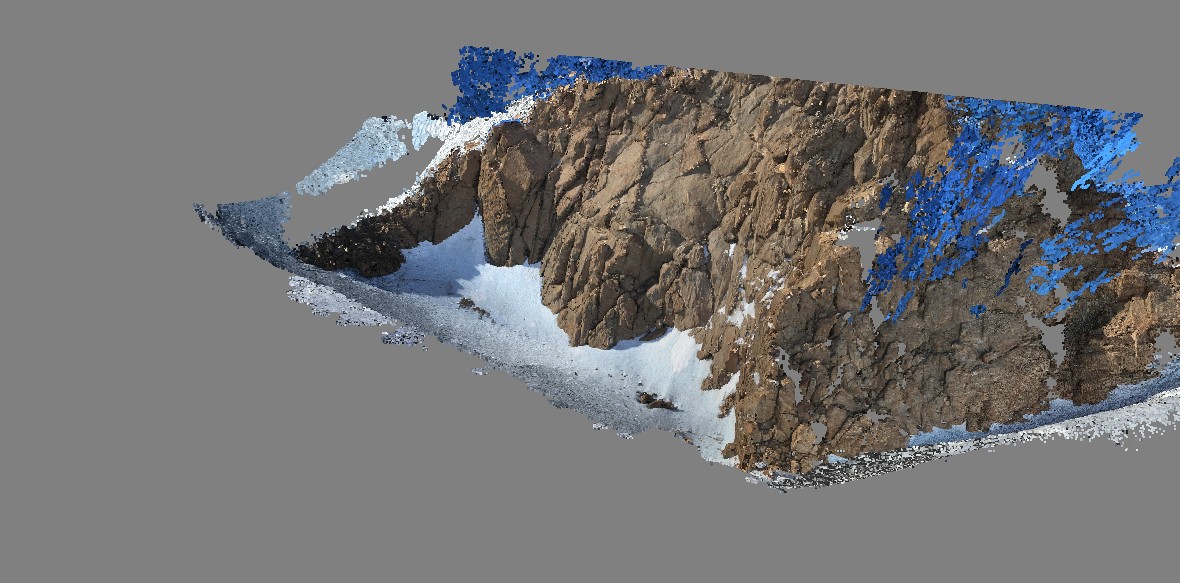
During this project I officially started working with repeat images taken at different angles to build high resolution digital elevation models. The technique is known as Structure from Motion (look it up online!). This is one outcrop that I created a high resolution digital elevation model of.
papa_north If you click on this PDF to the left titled papa_north and enable all functionality on it, you should be able to rotate the photo within the PDF to different orientations and actually see the Digital Elevation Model I created using Structure from Motion techniques on about 100 photos I took of the outcrop from different angles.

Melt only 300 miles from South Pole! Wow!!!!

The team at the Ohio Range: Jen, Sujoy, Grant, myself, and Zach.
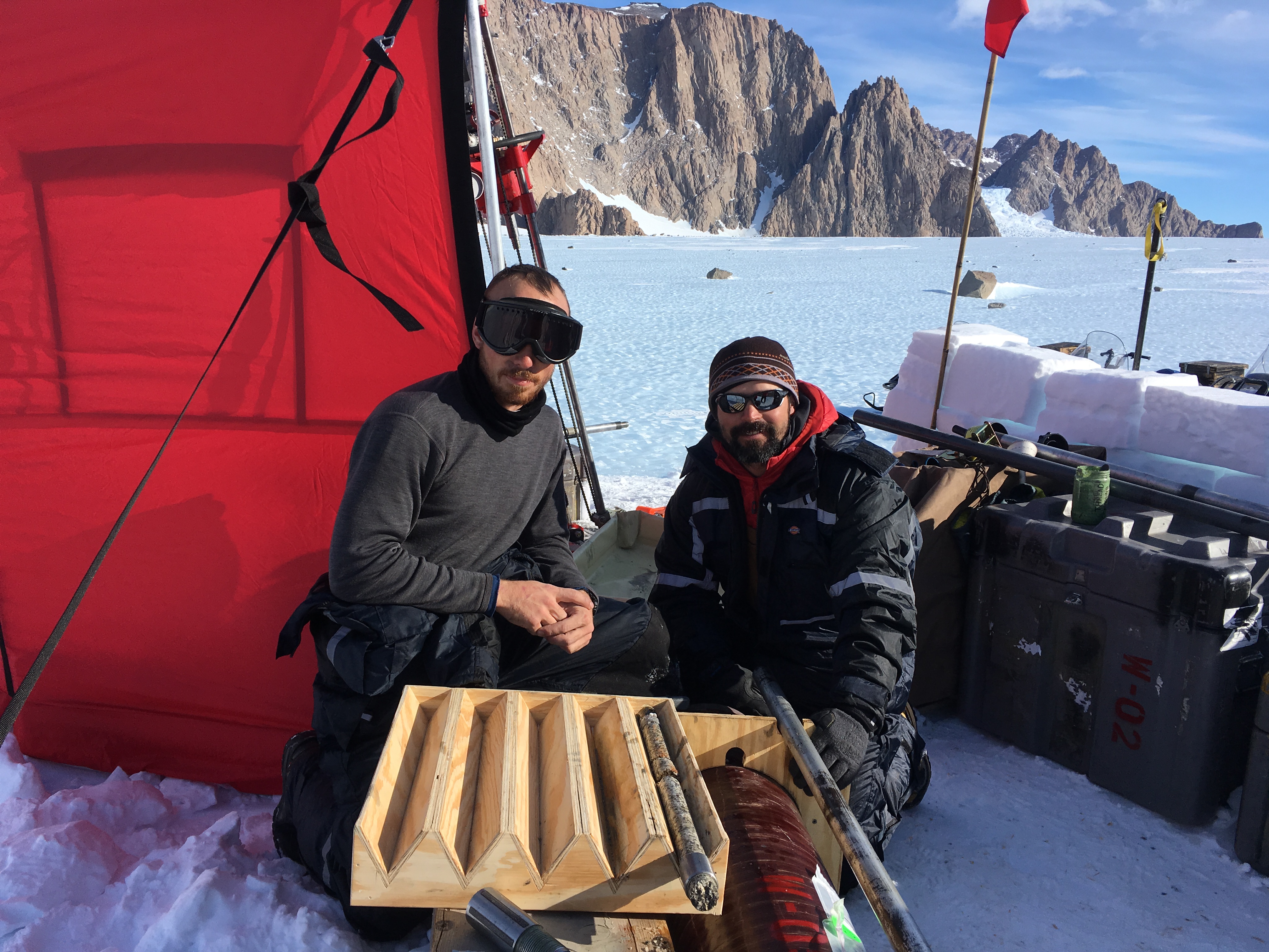
Grant and I in front of the very first rock core collected under glacier ice. Sujoy and Zac will use this rock core with some specific chemical methods to determine the last time it was exposed to sun (i.e. no ice cover). We collected 5 rock samples like this from under the ice. Results from this project will help constrain estimates of glacier change over time.

Grant holding a really nice (53 cm long) rock core that he was able to successfully drill for our team!

Drilling Setup to collect the first rock core under ice!

Testing my Ice Radar system with Jen to measure ice thicknesses in the Ohio Range. (Photo: Jen Erxleben)
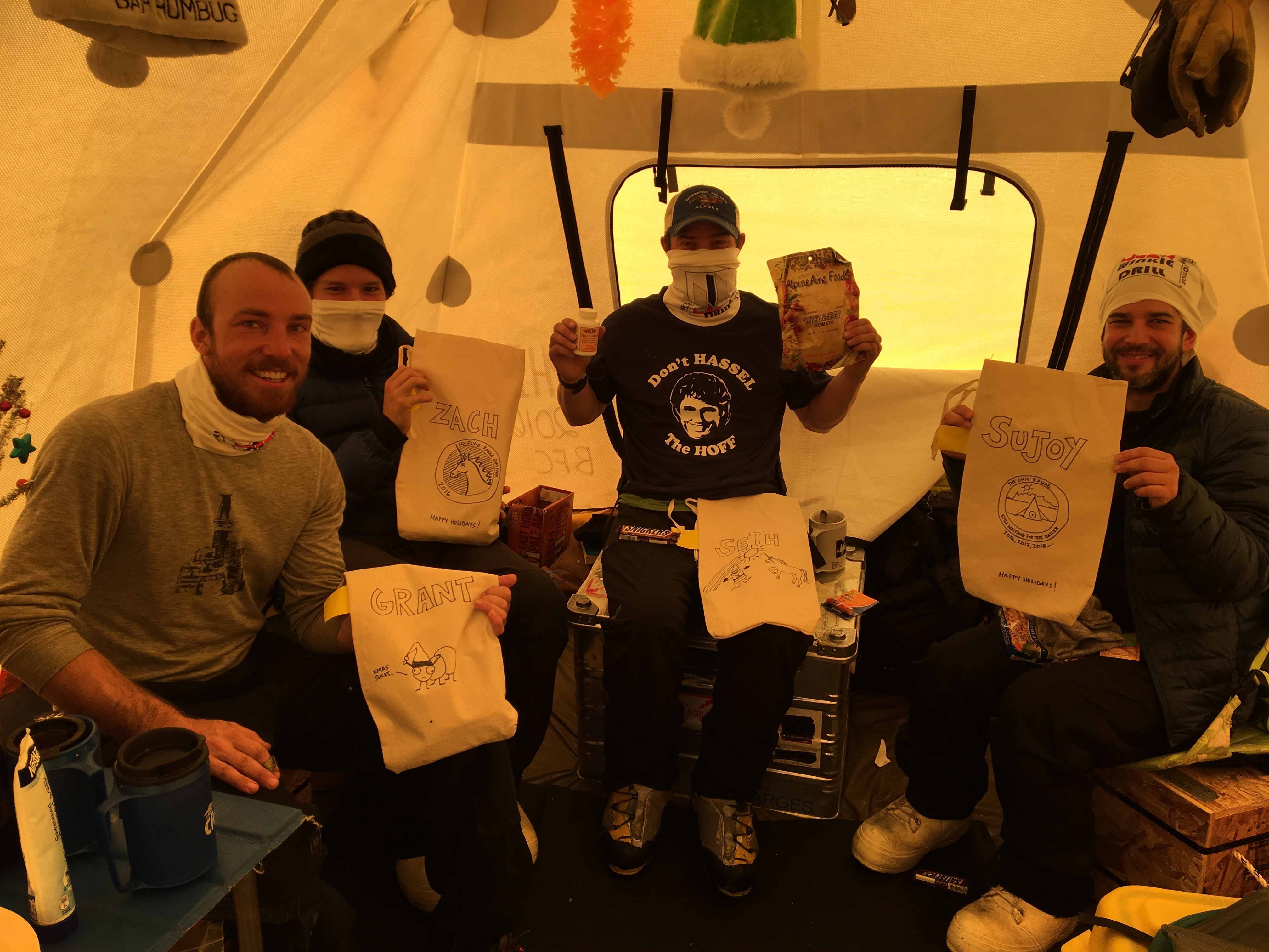
Christmas in the Ohio Range! Jen was amazing! She sketched each of these stockings and had surprises for each of us! And…. pay no attention to the tee-shirt I am wearing! (Photo: Jen Erxleben)

Pancakes for breakfast! (Photo: Jen Erxleben)

Sujoy holding a really cool piece of core. We drilled into the rock across a relatively steep face (40 degrees or so). This core has ice on the top right side and rock on the bottom left.
Amazing place to do radar. Beautiful golden granite surrounding us! (Photo: Jen Erxleben)
Pretty common to be windy in the Ohio Range!
Jen Erxleben took this hilarious timelapse video of me trying to walk gracefully, without crampons or ice creepers, on the heavily scalloped blue ice….
 Amazing panorama of the Ohio Range with me tinkering on the radar system. 2000′ high and several miles wide, the Ohio Range is a significant mass of golden granite! What an amazing place and a wonderful Antarctic Field Season! (Photo: Jen Erxleben)

Back to New Hampshire after a successful Antarctic Field Season. A couple days off for ice climbing was a great idea! Repentence in North Conway, NH

Well… the crux was a little too thin and delaminated for me to be psyched about climbing it, but the first pitch was a blast as always!

Dr. Bromley enjoying the ice!

Dr. Bromley and I discussing proposal ideas over a “day off” ice climbing!

Fafnir on Cannon Cliff… what an amazing place!

Fun to catch up with past University of Maine student and friend, Brian O’Leary, for a day of climbing at Cannon Cliff!

Mr. Ben Winn, Engineer extraordinaire, Computer Science wizard, and “off the couch” mutant climber…. Always fun to get out with him!

Well…. Bring on the next winter adventure!
