The Last Winter – By Porter Fox

In 2019, an author and friend, Porter Fox, joined us on the Juneau Icefield Research Program (JIRP). Porter grew up in Acadia and I met him through his childhood friend who became one of my long-time climbing partners, Chris (Toph) Kane. Toph was the first to suggest we team up to help Porter get this story out. Thanks for the idea Tophie! Porter’s mission was to share a story of research, education, collaboration, and science advocacy focused on warming temperatures impacting snow around the globe. I am happy to say that Porter accomplished this mission with the soon to be published (November 2) new book, The Last Winter. Porter’s book represents his incredibly beautiful, funny, and thoughtful first person account of scientists and other characters across the Northern Hemisphere who have a connection to snow and winter in some way. Porter’s journey includes the West coast of the U.S., Alaska, European Alps, and Greenland. He brings out the character of each person he meets, several from JIRP, including yours truly. Like any wonderful book, reading this caused me to laugh out loud, smile, and sense feelings of joy, happiness, sadness, and inspiration, all in one. This book is well worth your time to read or listen to! Enjoy!

Book Link: https://www.littlebrown.com/titles/porter-fox/the-last-winter/9780316460927/

I asked Porter some questions related to this book, his answers are below:

1. Did your perspective change on how the science community works together or SHOULD work together after your experiences meeting with scientists from across the U.S. and Europe, and if so how?

Answer: After reporting on many different sides of climate change and the scientific community, I was completely amazed by how tight knit the polar studies and cryosphere community was. I was literally on opposite sides of the planet talking to folks who had just been with interviewees from my last trip. Everyone seemed to know one another and everyone also seemed to be helping each other out. Nowhere was this more evident than on the Juneau Icefield. Not only were the researchers there at the very top of their field—something a journalist is always searching for—but they had worked with one another all over the world and hailed from labs and organizations with even more leading voices in the community. As I continued with my research I repeatedly saw names from the Juneau Icefield Research Program (JIRP) in peer-reviewed studies and even headlines in major newspapers—names that I met and walked with on the icefield. Finding the thesis of your book and then all of the supporting evidence is a long and winding trail, but this particular journey was like the yellow brick road in Wizard of Oz, with JIRP participants lining the way.

2. What strengths do you see from scientists of today and what do you think our broader communities should know about scientists working on the front lines of climate change?

Answer: I think the greatest strength of the scientific community today, even compared to 10 years ago, is its ability to get research and findings out to the general public. Peer reviewed studies are so much easier to access now, and the abstracts are always concise and get the point across. Research teams also seem to have better ties to the media, which allows for so much more cutting edge climate change news coverage—alerting the general public to what national policy decisions mean for our individual and collective futures. Scientists need not be activists the same way that journalists do not need to be activists. But the information needs to make it to the layperson, so that everyone knows exactly what is going on with the climate crises day-to-day.

3. If you could have people remember one point, idea, or concept from this book or from your own experiences writing this book, what would it be?

It is the old aphorism that everything is connected—so we need to take care of every element in our environment to preserve our own future. Remote glaciers in Greenland that no one will ever see could erase the East Coast of the United States and send Europe into a thousand-year Ice Age. If permafrost in remote regions of Arctic Canada thaws, it could release enough greenhouse gases to warm Earth as much or more than humans ever did. If snow pack in the Rocky Mountains melt out completely, the Colorado River and the primary fresh water source for 40 million Americans and a half dozen western US cities will dry up. All of this is connected, and one of the first major tipping points that could cause runaway climate change and major disruptions to our way of life is melting snow and ice. How do we stop it? Support science and vote. We need to pull out all the stops to save the fragile cryosphere that has helped maintain our relatively stable climate for 10,000 years.

4. We obviously have lots of environmental challenges that we face, and in many ways, an uphill battle. However, there are also many recent positive signs that can inspire action to deal with our environmental challenges. What is your inspirational message to readers who hope to enact change?

Data that scientists are pulling from ice cores, tree rings, soil and rock samples are providing the means necessary to hone climate change modeling, and truly predict what will happen in various emissions tracks being considered by nations of the world. By seeing how catastrophic a high emissions future can be, leaders are finally being scared into making good decisions—and realizing the existential threat that we are all facing. A vast majority of the world’s population is on board and ready to take action. The stubborn minority, rooted in the fossil fuel industry, is withering. The silver lining, as climate change mitigation plans are put into action: all of this research has brought us much closer to understanding how our world works, where droughts, floods, wildfires and rogue hurricanes come from and, possibly, how to live on this planet more equitably and harmoniously.

Black Lives Matter and COVID 19

clippedfigOut of respect for those experiencing recent racism across the United States, murders such as George Floyd as one of many examples, I have avoided posting about my  personal activities, recently.  Racism has been a centuries long battle for Black and other minority people. I admit I do not have much knowledge or experience with racism. I used to blame that on living in a nearly entirely white community.  However, I believe I am complicit for not having learned about racism until recent years.  Living in a white community is no excuse for not learning more and trying to help.  Frankly, I feel its been a failure of mine. So, learning and taking action is what I am spending much of my free and work time on, these days.  As one step, I’ve been reading a ton. The photo above shows some of the books I’ve started to work through.  I have other books on the way.  I recommend buying your own copies though your local book store, they are well worth reading. OR, check out Bookshop.org as a way to support local independent minority owned bookstores that may not be in your region. At a bare minimum, if you cannot afford to purchase one of these books, message me and I will loan one to you.

Likewise, with the suffering that is occurring due to COVID19 by those getting sick,  losing loved ones, losing their jobs and/or not having appropriate financial or healthcare support due to our government focused on bailing out big business instead of people, I have also avoided posting about my personal life.  I believe there is a time and a place for personal postings and that this is NOT that time or place. 

However, I will continue to post news of Black Lives Matters, COVID, and related societal or environmental issues which affect us.  I will also post details of organizations I believe are working hard on some of these major challenges facing society.  The reason I am posting on these topics is simple:  First, because human survival and our economy is inextricably linked to a healthy environment.  Second,  because environmental challenges disproportionately impact minorities and low-income people who often do not have the resources to take on big business that cause the vast majority of environmental and health issues that we face.  Third, because misinformation is rampant and me NOT posting on these issues, particularly considering my expertise falls into environmental matters, is complicit with those who spread propaganda, non-science based research, and racism.

We have a obligation to take care of our neighbors and friends when they are facing challenges.  I prefer a caring world over one that ignores suffering. I also believe that we will not make progress without reaching across borders because environmental issues know no political boundary, whether it is local, state, or country.  For those of you that say the U.S. does more relative to other countries, that is no reason to not continue the work.  In fact, the U.S. cannot afford to sit back, humanity depends on it. Please help become part of the solution as opposed to giving up.   

Here are three recent examples I’ve been working on that I hope inspire some positive conversation towards a better future.  I recommend you checking out these organizations: Protect Our Winters, American Alpine Club, and the Juneau Icefield Research Program.   

In the fall of 2019, I provided a public presentation in Southern Maine sponsored by Protect Our Winters (POW; https://protectourwinters.org/).  The presentation was titled “Climate Change 101 for New England” and focused on the science behind changes we are seeing in climate, what we expect to see in the future, and how future changes may impact New England, and specifically Maine.  More recently I participated in an event sponsored by POW, meeting with U.S. Representatives and Senators to discuss action items which would support environmentally friendly and economically viable initiatives for our country.  Of the 65 participants, 33 were professional athletes such as Jeremy Jones (professional snowboarder who founded POW), Jessie Diggins (gold medal cross country skier), Conrad Anker (professional climber), Jimmy Chin (Professional Climber/Photographer; Free Solo movie Co-Director), Caroline Gleich (professional skier), Tommy Caldwell (professional climber), Sasha Digiulian (professional climber), and many other talented and energized souls.  These athletes are using their very large public platform (which scientists do not generally have) to help spread the word on environmental action.  We had five participating scientists working with this team, including myself.  Others also participated as experts on renewable energy and the outdoor industry across the United States, providing science and economy facts and solutions which will help the U.S. improve our environment, create economic stability, AND help the U.S. lead other countries towards a more sustainable future.  I personally was on video calls with Senator Susan Collins and staff, Representative Jared Golden’s staff, Senator Lisa Murkowski and staff (Alaska), and Representative Chris Pappas (New Hampshire). Why is this important? My hope is that each of my colleagues and friends also reach out to their representatives and senators to ask them to support environmentally conscious and science-based solutions for the future.  Evidence shows that reaching out does make a difference.  

Link: https://protectourwinters.org/  

Screen Shot 2020-06-22 at 11.33.31 AM

POW

Secondly, for the past few years, I’ve been working closely with the American Alpine Club (AAC) on their “Climbers for Climate” initiative and as a scientist on their Climate Task Force (https://americanalpineclub.org/climate).  Their most recent effort is focused encouraging active outdoor people who care for our environment to educate themselves on environmental issues and vote with environmental considerations in mind.  Voting is the single most important action we can pursue as citizens to make a positive impact on our environment.  This INCLUDES local community engagement because many of the initiatives which will help our environment and economy, start locally.  On AAC’s website, you will note that the Juneau Icefield Research Program (JIRP) is a partner with them because both are working to increase science advocacy and the use of  science for making environmental policy decisions.  In a few weeks, a short article I’ve written for AAC should come out with a particular focus on Maine.  I urge you all to read it and consider the topics I discuss within your own communities. 

Link:  https://americanalpineclub.org/climate

Screen Shot 2020-06-22 at 11.25.24 AMLastly, and speaking of JIRP: Three years ago, I accepted the position as Director of Academics & Research leading the Juneau Icefield Research Program (JIRP; https://juneauicefield.org/black-lives-matter).  JIRP has been around since 1946 as the longest operating Polar research and education program in North America.  Last year we had over 80 people on the icefield between students, scientists, and educators. We hope to grow this number substantially in future years.  JIRP is globally known for bringing students onto the glaciers and mountains of Alaska and Canada to experience Earth systems science and research, first hand.  Prior students, staff, and faculty have been inspired by JIRP for decades and many have become leaders in their own communities and within the science, engineering, or science policy communities after JIRP.  One of my goals is to help train science leaders that go back and work on solutions within their own community. 

However, JIRP is not perfect. Like most science organizations JIRP has had its own challenges, historical failures, and current failures.  One ongoing failure is poor representation, poor inclusion, or not providing a sense of belonging for students, staff, and faculty of color, minority, or of less financial security.  JIRP follows the common theme in geosciences where over 90% of professors are white.  And, speaking of finances, JIRP is expensive.  It costs roughly $7500 for a student to traverse across the icefield each year, participate on research with scientists, conduct their own research, and learn from world-class scientists.  JIRP is a small program and our faculty volunteer 40,000 hours of their time, annually.  We have limited funding to support students who do not have the financial means to attend JIRP.  However, these limitations of JIRP are not a good enough excuse for a lack of inclusion and a lack of making all students/staff/faculty feel like they belong and have a voice that matters.  JIRP, like much of the geosciences has failed for decades in this realm.  JIRP needs to do better. 

I did not take the position leading JIRP to mentor only privileged students.  I accepted the position (applying for this position in 2011 and again in 2017) to make a difference for those who are less fortunate, to provide opportunities for those students who think they don’t have other options.  I absolutely believe in JIRP and what JIRP can do for students and society.  But, its been a constant battle, a labor of love, many stressful decisions and disappointments, feelings of being cut down despite our best efforts, declined proposals, or even challenges within my own career path limiting what I can do for JIRP.  For example,  as a Tenure Track Assistant Professor, my performance reviews over the next few years are based primarily on my productivity publishing papers and receiving federal grants from proposals that I write. My success in these two topics mostly determines whether I keep my role or am fired.  Unfortunately, most academic institutions do not place as much value on supporting and mentoring students in the science community.  This absolutely needs to change and its perhaps up to my generation to push hard on academia to make this change.   

BUT, there is light on the dark horizon of geoscience that I see coming from JIRP.  In recent years JIRP has had about a 55% to 40% female to male ratio of students, we have been supporting non-binary students, and our faculty has been fairly well close to a 50/50 split of male and female.  This coming year, it looks like we may have at least one new program starting which will support all first generation college students and minority students, almost free of charge.  I hope this new program works as a model for future JIRP-type programs which help engage more students and help them feel a sense of belonging. This could be a tremendous step in the right direction.  We are also developing new teams to help improve diversity, inclusion, equity, and justice on JIRP.  And we are re-assessing our strategies to not only welcome minority students but more importantly, make sure minority students feel like they belong at JIRP and within the geosciences.  We want each of our students to know that we truly care for them, that we are here for them, that we are listening, and that we are working on actions to be the societal change needed for future generations. 

Link: https://juneauicefield.org/black-lives-matter

Screen Shot 2020-06-22 at 11.25.56 AMI know many of my friends, family, and colleagues are doing similar things and I have seen many positive examples over the recent month. I hope that this energy continues into the future and that this marks the turing point of true change. Without supporting each other, caring for one another, and caring for our environment simultaneously, life on our unique planet is certain to change for the worse and I fear greatly for what the next generation will face.  

What its Like to be on a Glacier

Hi all,

As a hobby that many of us pick up in the back-country, I now have gigabytes of videos and photos to share with the broader community.  I’m new to videography, so please forgive the shakiness in the video below. However, hopefully this post helps you understand the grandeur of the mountain and glacier areas that we often frequent.  Enjoy!


Eclipse Icefield and Mount Logan:  Bad Weather, Good Reading, and Fun Science!


I have lots of writing to catch up on, including three field project reports.  I’m going to work in reverse though and will need a little more time to explain the science of each project because I have lots of catch up now that I’m back in internet land.  But here is a teaser for this most recent trip to Eclipse Icefield and Mount Logan in the Yukon Territory of Canada.

IMG_3177

The terminus of kaskawulsh glacier near Kluane as we fly in towards Eclipse Icefield.

Karl Kreutz and I are now sitting in the Vancouver Airport reminiscing about this field season to Eclipse Icefield in Kluane National Park of the Canadian Yukon for the second year in a row.  We also visited another site that was new to both of us, Mount Logan.  To be honest, of all the projects I’ve worked on over the past decade, Mount Logan was one of the most exciting.  See, many people claim that Mount Logan represents the largest volume of any mountain in the world.  Logan is also the second highest mountain in North America, second only to Denali, which Kristin and I climbed last year with our good friends Blaine and Patrick to measure ice thicknesses at the summit and install a new USGS survey marker.  The exciting thing about Logan to me is that is far more remote and less publicized than Denali.  It makes you feel like you are much more on your own.  In fact, when Karl and I were waiting for our final flight back to Kluane National Park after our season, we were over 70 miles from the nearest person in any single direction across some of the most rugged mountains and glaciers in the world.  To sit and wait for a plane ride knowing this, to me is more inspiring than sitting at similar remote sites in Antarctica where you are surrounded by flat white for hundreds of miles around.  For some reason, the great Alaska and Canadian mountains have always been a mystical place for me.  Their ruggedness, broken crevassed surfaces, and seemingly impenetrable boundaries, surrounded by tumbling rivers of glacial melt water, ice falls, and towering walls that in many cases reach over a mile high, can be quite humbling.

Prior to the Mount Logan portion of our trip, Karl and I had two other students, Brittany Main and Will Kochtitzky from University of Ottawa and University of Maine, respectively, join us for about a week of work at Eclipse Icefield where we also spent a month last year.  We collected some more radar data for both of their respective graduate work and a 17-m long ice core for one of Karl’s new graduate students who will start this fall at Maine.  One particularly fine experience during our week with Brittany and Will included a 6-mile traverse down Donjek glacier towing three separate radar systems to measure ice thicknesses and look at layering within the snow and firn.  Radar results showed ice as deep as 750 meters along the traverse.  We dropped about 3000 feet in elevation and then climbed back up to the ice divide, making a very long day for all of us.  Brittany and Will were troopers and worked hard towing their respective radar systems all day long.  We also had an artist, Leslie Sobel, join us for the week.  Karl and I are looking forward to seeing results from her photographs and plan to work with Leslie on some outreach material in the future.

IMG_3183

Skiing with Will, Brittany, and Karl out to a rock outcrop near Eclipse Icefield to retrieve a temperature logger which recorded air temperatures through the winter.

IMG_3196

Karl and team processing core samples from the 17-m deep ice core.  

IMG_3198

Sometimes when the weather was nice, we had some great sunsets!

Prior to our departure from Eclipse Icefield (and during our time at the icefield for that matter) weather was consistently poor.  In fact, relative to last year, it was horrible.  I think in 2016 we had a couple non-working days during the entire month at the site, whereas this year, we worked maybe ½ of the days because of poor visibility, wind, and snow.  After Will, Brittany, and Leslie departed, Karl and I were planning to fly immediately to Mount Logan to meet two others, Adam Toolanen and Aaron Chesler.  Both I met as students of mine on the Juneau Icefield Research Program in 2011, and both have been steadily moving up in the world with their education and career.  Chesler is now a PhD student working with Karl and other professors at Maine while Adam completed his degree in Aerospace Engineering and just completed training as a commercial helicopter pilot.  Unfortunately, weather had different plans for meeting Adam and Chesler immediately.  Karl and I waited for the weather to clear for at least 3 days before we met with Chesler and Adam.  After a few feet of snow, we were transported by Icefield Discovery plane to Mount Logan to meet the others.  I wish I could say that was the end of the poor weather but it wasn’t.  We averaged about 3 to 5 days of poor weather to every one good day which resulted in completing about ½ of the objectives on Mount Logan unfortunately.  We were ultimately able to reach King Col at 13500 feet above sea level where a Japanese team had extracted an ice core from in 2002.  At this site, we collected about 4.5 km of radar data (see attached unprocessed example) collected some snow samples in a pit that Karl dug.  The radar showed over 250 meters of ice at its deepest location which was impressive to us considering the site was only 500 meters wide from valley wall to valley wall!

IMG_3227

Base camp view down glacier at the King Trench Route of Mount Logan

IMG_3220

Aaron Chesler on a ridge climb we used near base camp to help everyone acclimatize to the higher elevations.

IMG_3234

Looking up glacier towards King Col from Camp 1 at 10800 feet above sea level.  King Col is at the saddle in this photo below the sun.  It may not look like it, but that little hill is almost 3000 feet in elevation gain!

IMG_3272

A Panorama of King Peak (left of the sun) and Mount Logan (right of the sun) from the southern side of King Col at 13500 feet above sea level, looking north.  BEAUTIFUL!

IMG_3274

King Peak!  Impressive mountain if it wasn’t for the fact that its attached to the second highest mountain in North America!

One positive for the bad weather is that I read several great books while being tent-bound.  Over the past few years I’ve been chugging through many classics with hopes of redeeming myself to my awesome high school English and literature teachers.  I may not have been as studious and focused in high school as I am now so I hope Mrs. Stafford and Mr. Walsh forgive me for my younger age and are proud to know I’m reading or re-reading many classics now!  Over the past few months I’ve read, amongst other less well known books, To Kill a Mockingbird and Harper Lee’s sequel that she wrote before Mockingbird but didn’t publish until the year before her death, Go set a Watchman, Old Man and the Sea, Slaughterhouse 5, Cats Cradle, Catcher and the Rye, 1984, The Illiad, and about ½ of Catch-22. I’m having a hard time getting into the last book!  Other great reads which relate a bit more to our location were Arctic Dreams by Barry Lopez (who doesn’t want to read about Arctic exploration, Arctic societies, Narwhals, and Polar Bears!) and Escape from Lucania, a classic true story mountaineering epic about Bob Bate’s and Brad Washburn’s traverse to the summit and off nearby Mount’s Lucania and Steele, and back to Kluane on foot over 125 miles when their plane didn’t return for them because the snowpack was too unstable to land on.

figure 1

100 MHz radar profile across King Col showing ice thicknesses of the glacier to over 250 meters deep.  Lots of crazy stuff in the shallower snow and ice layers that Ill study and try to explain later!

IMG_3276

Chesler and Adam extracting a 13.5 m deep core on the King Trench Route.  Karl’s new student will analyze this core along with samples from several other locations across Canada and Alaska for her MS degree starting in September.

IMG_3290

Karl reading while waiting for our flight off the glacier, 70 miles from anyone…

IMG_3295

Pickup by Icefield Discovery at the end of our field season on Logan.  Thanks Sian, Lance, and Tom!

IMG_3398

A lake on Kaskawulsh Glacier that our colleague Gwenn Flowers (from Simon Fraser University) and team are studying in Kluane.  They are curious about the timing of lake drainage and where that water goes when it drains under the ice.

Anyway,  Ill dive a little more into the sciences and science results from our projects once I have a little more free time this summer, but for now, enjoy some great photos of this year’s research at Eclipse and Logan!  Thanks so much to Will, Brittany, Leslie, Adam, Chesler, the team at Icefield Discovery and Kluane, and Kluane National Park for your help this season!

IMG_3448

Adam, Karl, myself, and Chesler at the Whitehorse Airport, end of the season!  

From Alaska to Antarctica and Several Places In Between!

It’s been quite some time since I’ve blogged about my on-goings.  Since climbing Denali in May of 2016 with Kristin, Blaine, and Patrick, I’ve taught a field geology-geophysics course for UMaine in New Hampshire and Vermont which included several lake surveys with radar by canoe; moved to Seattle for 1-2 years to work with an amazing group of scientists at the University of Washington Department of Earth and Space Sciences; had many fishing, climbing, and other outdoor weekend adventures in Olympic National Park, Mt Rainier National Park, and the Cascades; been to two weddings (one of which I performed the ceremony of for my best friend, Jacob, and his amazing wife Jesse!); returned to the Eastern Alaska Range in September for a short two day field season of GPS measurements; been to Antarctica conducting research on two different projects I’m involved in; and climbed in New Hampshire for a few days of relaxation after my winter field work.  Now I’m back in Seattle preparing for my next field season in Eastern Alaska with the UMaine and Dartmouth crew.

I missed Thanksgiving, Christmas, and New Years away from my wonderful family.  We have very sadly lost some friends and family in the world recently.  But, I also have some wonderful memories from the past nine months.  Instead of a long blog today, I thought a bunch of photos/videos that reflect where I’ve traveled, outdoor adventures I’ve pursued, the friends I’ve spent time with, and some science I’ve completed, would be more fun for people to look at.  Enjoy!

img_6718

Relaxing with Kinley in the hammock after a spring and early summer full of field work!

img_6741

Getting ready to conduct a radar survey of lake bottom stratigraphy with my long time mentor, Steve Arcone, and a student from UMaine. Perfect day to be on the water!


img_6737

Steve doing what he is the master of (GPR)! Tom and I getting ready to paddle.

picture4

A radar profile collected across a lake in New Hampshire showing water depth, layered sediments, and bedrock or till under the sediments. The sediments re probably made up of fine grained sands and silts deposited since the last glaciers retreated in this area over 12000 years ago.


img_6797

Jeep loaded down with clothes, bicycle, books, and outdoor gear, ready for the move from New Hampshire to Seattle!

img_6836

Some of my best friends that we were able to visit during our cross country road trip! Jacob (left), Kristin, and Jesse (right).

img_6854

Kristin and I were also able to visit her best friend, Abbey, for an evening during the road trip!

img_6844

Kinley (right) has a long lost brother, Abbey’s puppy (on the left)!

img_0441

Kristin’s prior office mate from Dartmouth, Lee, just happened to be in Bozeman, Montana when we were driving across country! Found a beautiful hike to spend an afternoon with her. This was also a great excuse to get Kinley out to stretch her legs!

img_6905

Arrived in Seattle, ready to roll. BUT, work doesn’t mean I can’t get out and play in the mountains on the weekend! Here, my good friend Brad tops out on a climb we completed in the Cascades. Brad and I have been on five field research seasons together so far and have another planned this spring!

img_20161015_094608

Friends from Maine! Scott Higgins, Tom and Dave Cassidy paid me a visit in Seattle to climb some in the Cascades. Too bad the weather was not great but we still had fun.

img_20161015_1417191

Well… when its raining we find something else to do…. Like go check out Leavenworth during Octoberfest!


img_5483

Climbing at Washington Pass with some Juneau Icefield Research Program friends: Scott and Isabel!

img_5488

Washington Pass is a pretty amazing area!

img_5500

Classic granite on an amazing fall day in the Cascades!

fig-1

Ok…. so I have actually done LOTS of work this year as well… in fact, about 6 months of time away from home on field work. This is a map of McMurdo Ice Shelf in Antarctica. Last year we collected about 1300 km of radar in the grid on this map to look and the internal structure of the shelf. The next several photos are figures from the radar data we collected that I have finally processed.

mis

This radar profile was collected from the sea ice onto McMurdo Ice Shelf. You can see lots of cool internal features but too much to explain fully here. feel free to email me though if you have questions about the profile!

fig-2

Another cool radar profile with TON’s of cool glacier-ocean-ice flow features occurring here.

fig-8

And another….. this profile crossed the convergence of two glaciers basically! Pretty cool to see where the ice mass from one glacier ends and the ice mass of another glacier begins!

fig-7

Fractures in the bottom of the ice shelf show up as these hyperbolas.

fig-13

Another profile taken across the transition from sea ice onto the ice shelf. Only this profile shows a bunch of folds in the ice from land that the ice is obliquely running into.

fig-12

a to a’ on this photo (courtesy of Ben Roth) shows about where the last radar profile was collected. You can also see the folds on the surface as the ice shelf moves towards the open ocean but also pins up against hut Point Peninsula (which causes the ice to fold).

picture2

Ht Point Peninsula is an interesting location. This is where vehicles from McMurdo and Scott Base access McMurdo Ice Shelf where the runways are located for transporting people to and from the ice. The folding at this location is worrisome to the folks in charge of McMurdo operations so we are studying the neighboring hillside to see 1) how much ice is there and 2) how fast that ice is moving down hill. We are doing this to determine if we may be able to put a road on the hillside that accesses the ice shelf further up-glacier and bypasses the major folding of the ice shelf in this area. This figure shows ice depths on the hill side and ice flow velocities measured using very high precision GPS survey instruments.

picture3

I am also modeling the ice flow on the hillside. This is a block model of the hill based on ice thicknesses determined by radar and surface topography determined from a high resolution digital elevation model. The basics: my numerical model matches observations pretty well. BUT lots more to add to the model!

img_0262

Collecting GPS information for ice flow velocities (shown a couple photos back) on the Hut Point hillside.

img_0273

Colleagues helping me collect radar ice thickness measurements on the Hut Point Hillside. Thanks John, Trevor, and Perry! (notice we are roped up to keep us safe from any potential crevasses buried under the snowpack). Also notice Mount Erebus and Castle Rock in the background, two iconic features of Ross Island.

img_0433

I finished my first Antarctic project on time… so, with some evenings of down time, I was able to take a rec trip to see some of the other local sights. Here is an iceberg frozen into the sea ice.

img_0387

Scotts Hut at Cape Evans which was used by part of Sir Robert Falcon Scott’s team between 1911 and 1913. Pretty amazing history here and well worth researching yourselves. Recommended reads include: Scotts Journals which chronicle his attempt to reach the pole, right up to his death at the very end; and “Endurance: Skackletons Incredible Voyage” which chronicles Shackletons attempt to reach the pole but getting stuck in pack ice instead!

img_0382

Just some cool wooden crates by Scotts Hut!

img_0322

Zoom of a little guy wandering around on the sea ice while we were on our way back from Cape Evans! Amazing little guy!

 A video of Mr. Penguin paralleling the road.  We didn’t want to disturb him with the vehicle so we stopped, and let him walk on by as he was travelling to who knows where!

A video taken from Observation Hill which is situated in between Scott Base and McMurdo Station.  In the video you can see Mount Erebus, Castle Rock, McMurdo Station, the sea ice, the ice shelf-sea ice transition, the Royal Society Range across the sea ice which is located in the dry valleys, White and Black Island, and the McMurdo Ice Shelf.  Amazing day up there with colleagues, Ryan, Zoe, and Fegy!

A video panning around while surveying the Hut Point Hillside looking towards the significant folds of ice at the ice shelf sea ice transition.

ohio-velocities

On to the next project! Ohio Range, or what we called the “No-Fly-O” Range because it is a notoriously difficult place to reach. About 300 miles from South Pole in a region where weather converges from the East Antarctic Plateau and storms coming from the coast across West Antarctica. BUT, our pilots and NSF support folks did an amazing job this year and we got out to our study site quickly! The arrows are velocities measured using GPS stakes installed last year and remeasured this year.

ohio-range-1

A really cool radar profile showing bedrock below ice, as well as ice rich till and contacts between firn and blue ice…. yep… lots going on so I will avoid describing all the details… just take if from me that this profile is really cool!

dem

During this project I officially started working with repeat images taken at different angles to build high resolution digital elevation models. The technique is known as Structure from Motion (look it up online!). This is one outcrop that I created a high resolution digital elevation model of.

papa_north  If you click on this PDF to the left titled papa_north and enable all functionality on it, you should be able to rotate the photo within the PDF to different orientations and actually see the Digital Elevation Model  I created using Structure from Motion techniques on about 100 photos I took of the outcrop from different angles.

img_1054

Melt only 300 miles from South Pole! Wow!!!!

img_2078

The team at the Ohio Range: Jen, Sujoy, Grant, myself, and Zach.

img_0847

Grant and I in front of the very first rock core collected under glacier ice. Sujoy and Zac will use this rock core with some specific chemical methods to determine the last time it was exposed to sun (i.e. no ice cover). We collected 5 rock samples like this from under the ice. Results from this project will help constrain estimates of glacier change over time.

img_1001

Grant holding a really nice (53 cm long) rock core that he was able to successfully drill for our team!

img_2081

Drilling Setup to collect the first rock core under ice!

img_2117

Testing my Ice Radar system with Jen to measure ice thicknesses in the Ohio Range. (Photo: Jen Erxleben)

img_0298

Christmas in the Ohio Range! Jen was amazing! She sketched each of these stockings and had surprises for each of us! And…. pay no attention to the tee-shirt I am wearing! (Photo: Jen Erxleben)

img_0234

Pancakes for breakfast! (Photo: Jen Erxleben)

img_0217

Sujoy holding a really cool piece of core. We drilled into the rock across a relatively steep face (40 degrees or so). This core has ice on the top right side and rock on the bottom left.

img_0227

Amazing place to do radar. Beautiful golden granite surrounding us! (Photo: Jen Erxleben)

Pretty common to be windy in the Ohio Range!

Jen Erxleben took this hilarious timelapse video of me trying to walk gracefully, without crampons or ice creepers, on the heavily scalloped blue ice….

img_0206Amazing panorama of the Ohio Range with me tinkering on the radar system. 2000′ high and several miles wide, the Ohio Range is a significant mass of golden granite! What an amazing place and a wonderful Antarctic Field Season! (Photo: Jen Erxleben)

img_2496

Back to New Hampshire after a successful Antarctic Field Season. A couple days off for ice climbing was a great idea! Repentence in North Conway, NH

img_2499

Well… the crux was a little too thin and delaminated for me to be psyched about climbing it, but the first pitch was a blast as always!

img_2500

Dr. Bromley enjoying the ice!

img_2502

Dr. Bromley and I discussing proposal ideas over a “day off” ice climbing!

img_2589

Fafnir on Cannon Cliff… what an amazing place!

img_2592

Fun to catch up with past University of Maine student and friend, Brian O’Leary, for a day of climbing at Cannon Cliff!

img_2472

Mr. Ben Winn, Engineer extraordinaire, Computer Science wizard, and “off the couch” mutant climber…. Always fun to get out with him!

img_2237

Well…. Bring on the next winter adventure!

A Denali Recap!

Sorry for the delay in an end of season summary but it was quite a whirl wind once we summited Denali, returned to Talkeetna, and traveled back to our respective home states.  The main take home points from the season include:

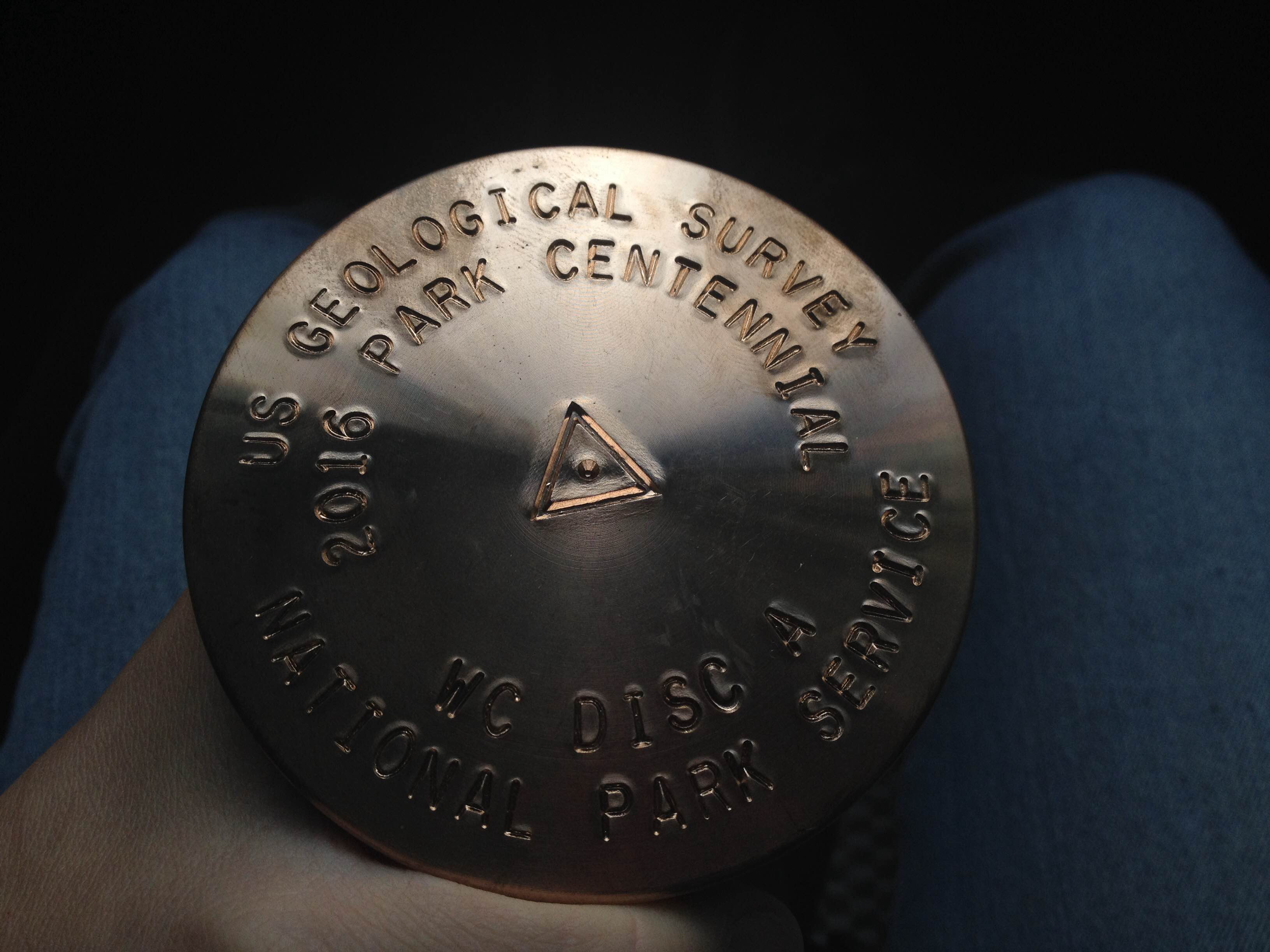
  • Blaine and Kristin were able to install a USGS survey marker at Windy Corner (13,500 fasl) for long term monitoring of tectonic movements in the Alaska Range. Just as importantly, Blaine was able to record GPS information over the marker with our GPS base station for over 5 days which will be a great first year dataset for comparison to measurements in the following years.

    RIMG1061

    Blaine with the newly established USGS survey Marker at Windy Corner.

  • Patrick was able to collect snow samples at Kahiltna Basecamp (7,600 fsal), Kahiltna Pass (10,200 fasl), Camp 14 (14,200 fasl), and High Camp (17,300 fasl) for comparison to the snow chemistry at the ice core drill site our collaborative team drilled at Mount Hunter (13,000 fasl) in 2013. This information will help us understand atmospheric chemistry as a function of elevation in the Alaska Range which is important for interpreting our ice core record we recently acquired.

RIMG1065

Patrick digging a snow pit to collect snow samples from for comparison to the Mount Hunter ice core collected in 2013.

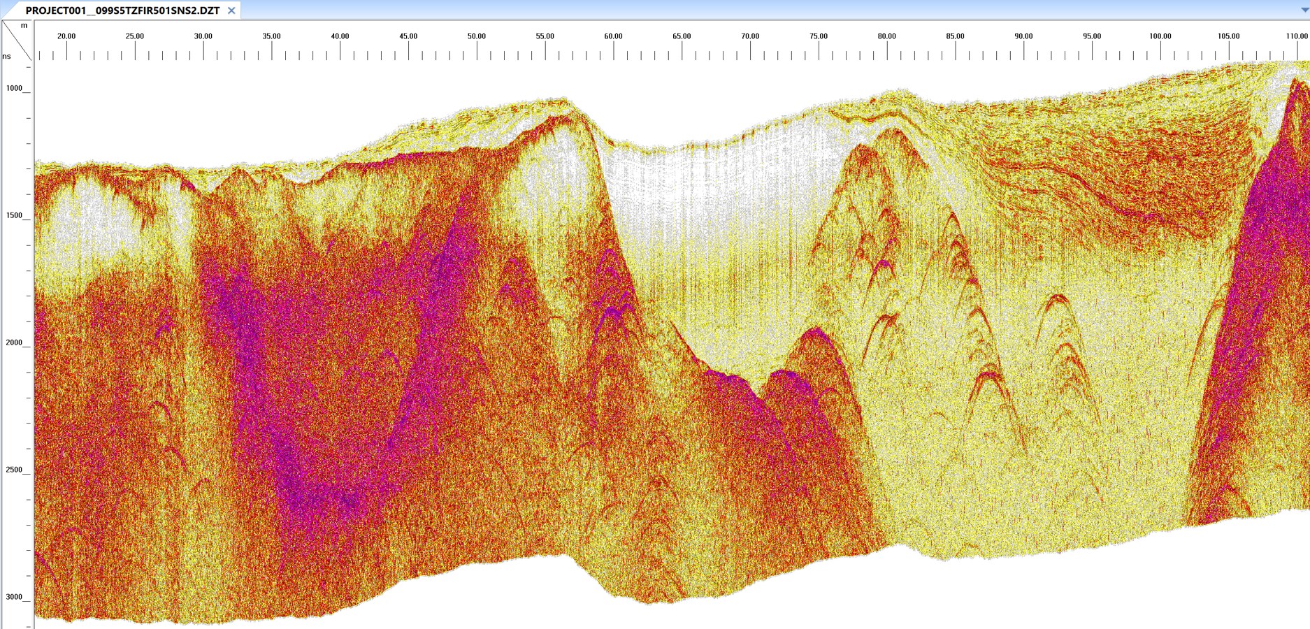
  • We were able to collect ground-penetrating radar ice thickness measurements from the summit of Denali! This was the final challenging science endeavor of the season and included carrying the radar and GPS equipment to the summit as a team.  Kudos especially to our young and very strong Patrick who carried both a car battery and the GPR control unit while the GPS gear, cables and radar antenna was split between Kristin and I.

    RIMG1122

    Kristin and I collecting GPR data at the summit of Denali

    Did I say car battery? Well… that’s not entirely correct.  It was ONLY an 18-amp hour 14-pound battery that Patrick carried, along with the 10 pound GPR control unit. (I say ONLY, jokingly).  Normally 60 extra pounds of gear spread between three people would not be a big deal, but the reality is, carrying that extra weight of science gear to the summit of the highest point in North America, along with the technical climbing and safety gear we needed to carry, is no small feat for a mere mortal research team.  We were happy to try it, but the extra effort beyond what climbing teams were expending to reach the summit, was certainly enough of a workout for all of us.  BUT, I digress and am jumping ahead of myself here.  Let me tell the entire story from Camp 14 to the summit and back…

    RIMG0989

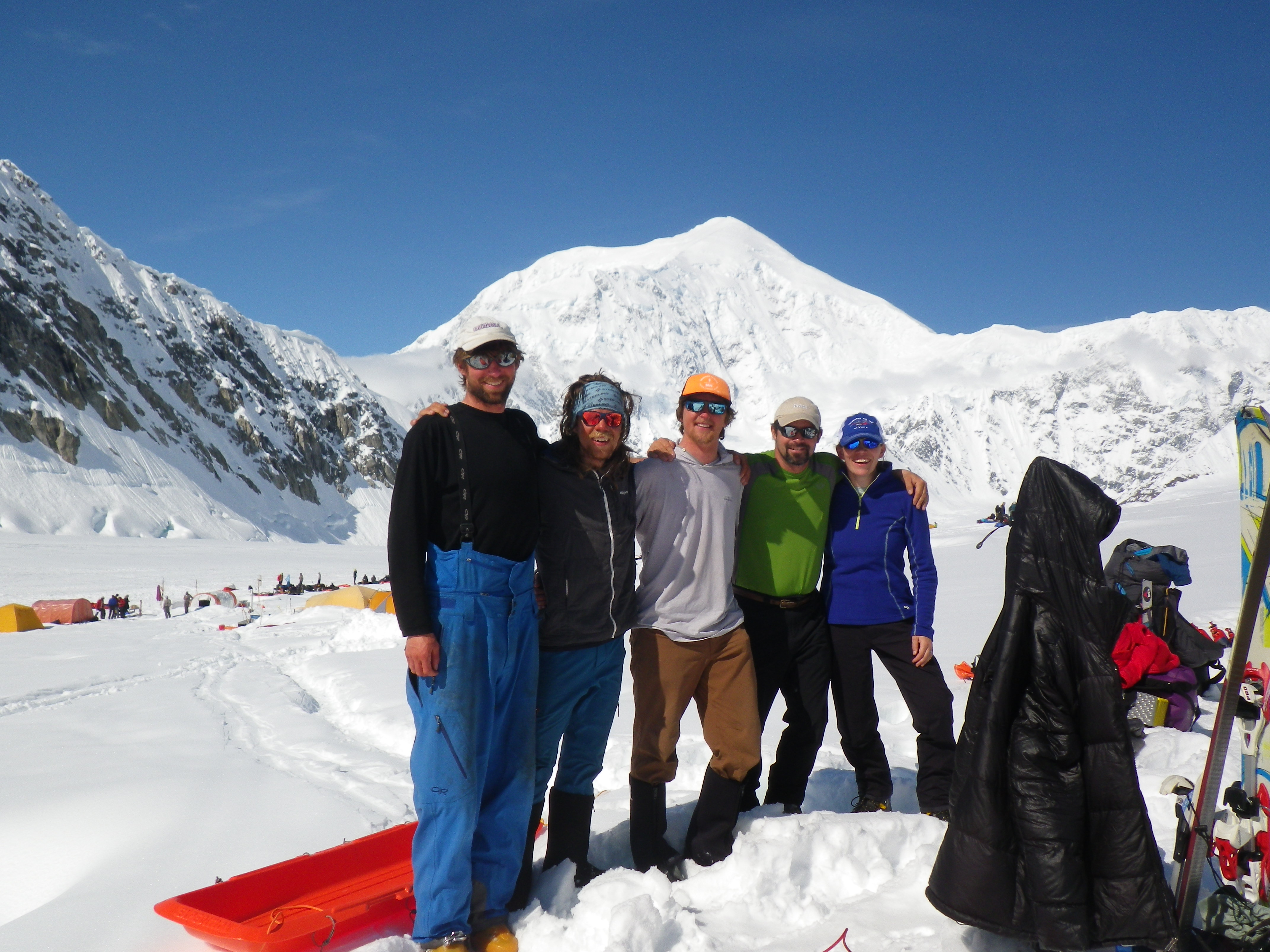
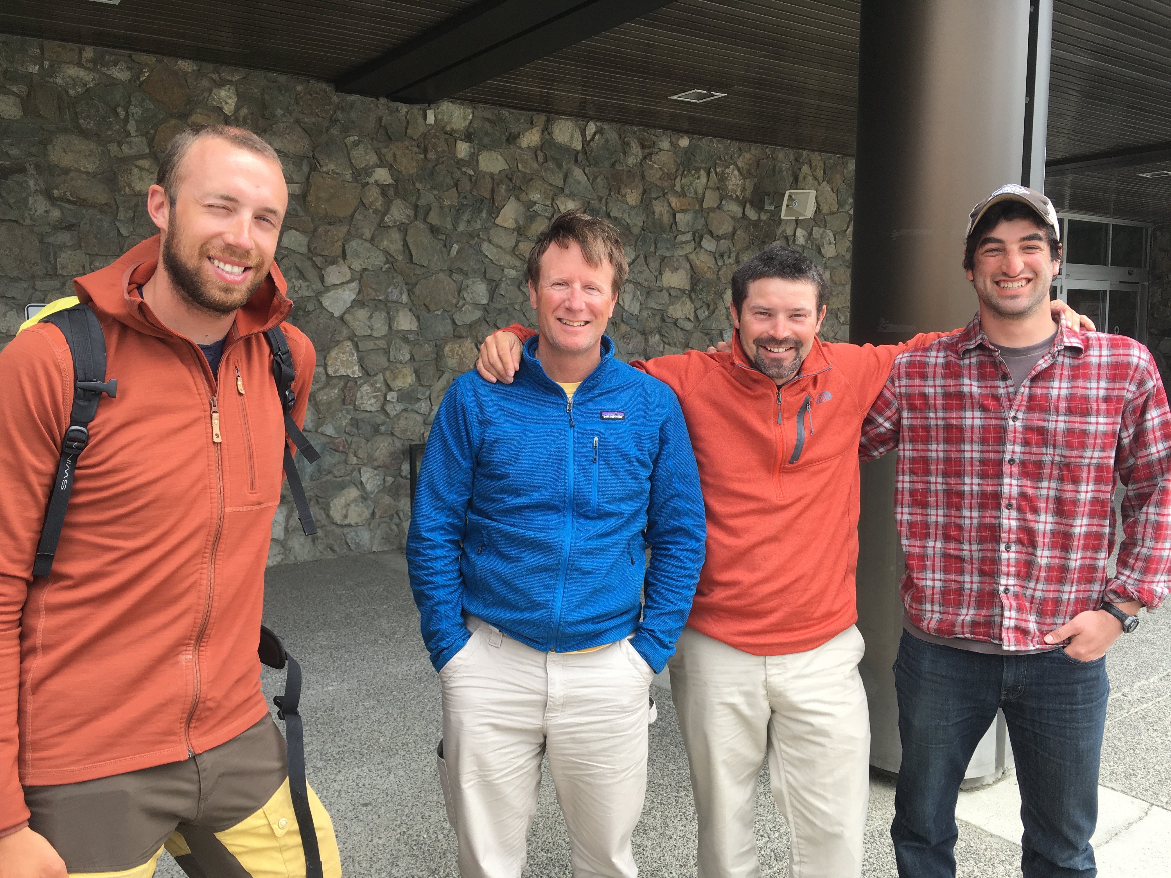
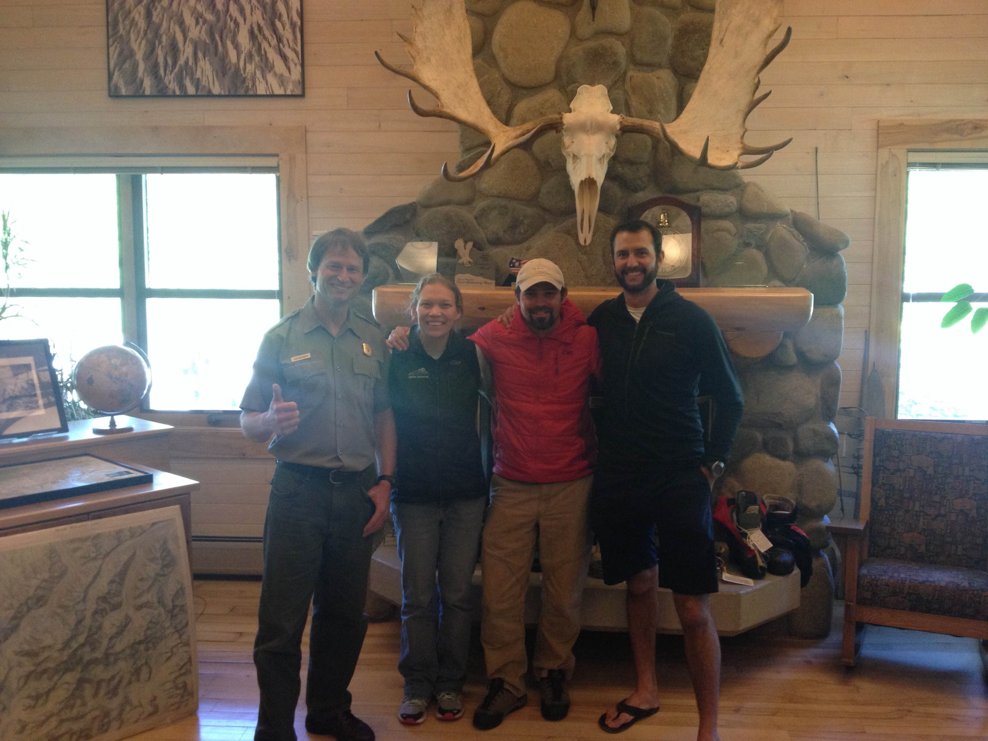
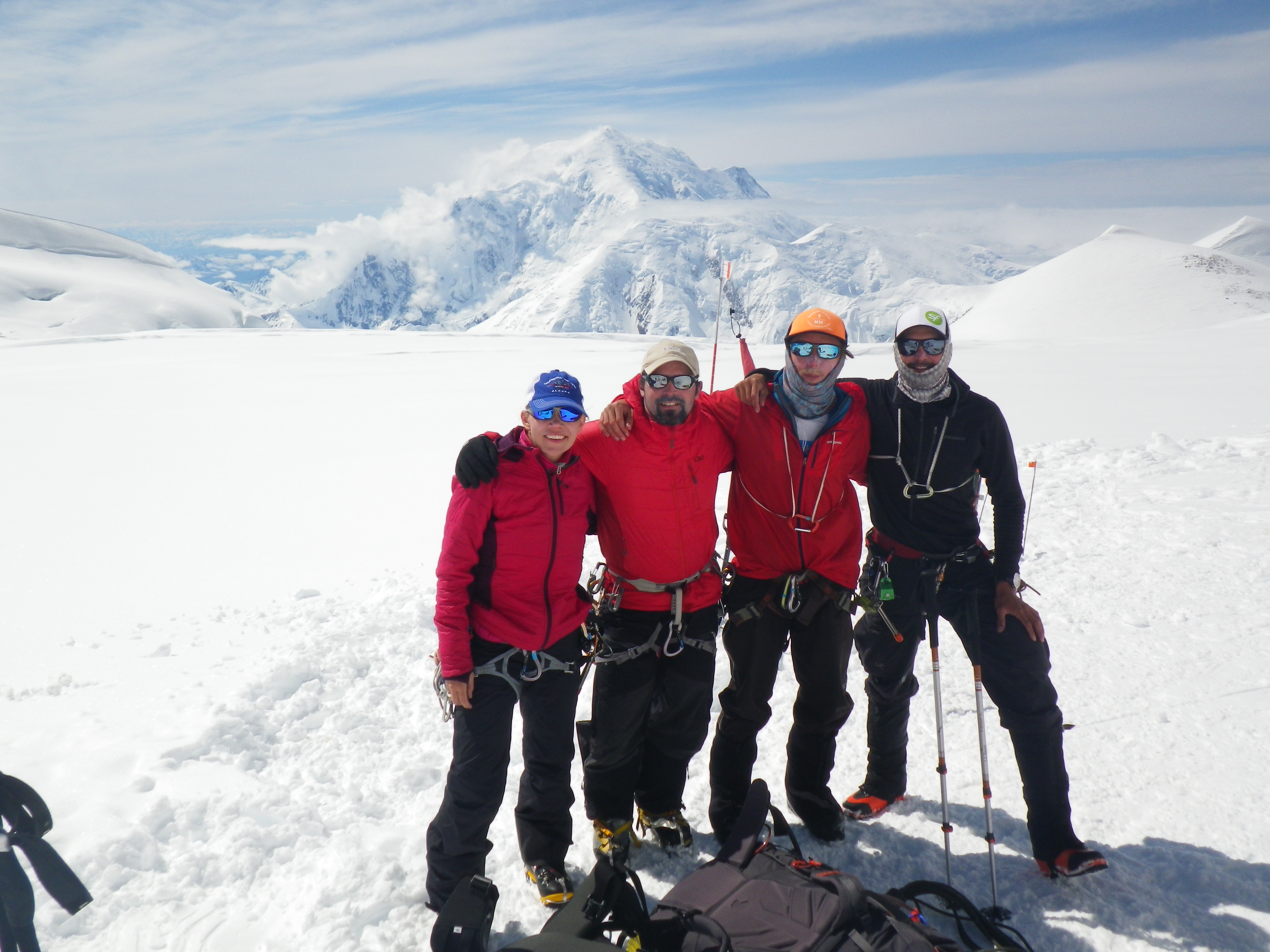
    Friends at basecamp!  (L to R) Dom Winski, Jimmy Voorhis (guiding on the mountain but prior MS student at Dartmouth), Patrick, myself, and Kristin

    RIMG1000

    About 1/2 way to Camp 1 (which is at 7800 fasl).  Only 12500 feet in elevation gain to go for the summit of Denali (background)!

    RIMG1070

    Patrick cooking up a hearty dinner in our camp 11 snow cave!

RIMG1010

Lounging in the Camp 11 snow cave while I wait for snow to melt for water!

RIMG1026

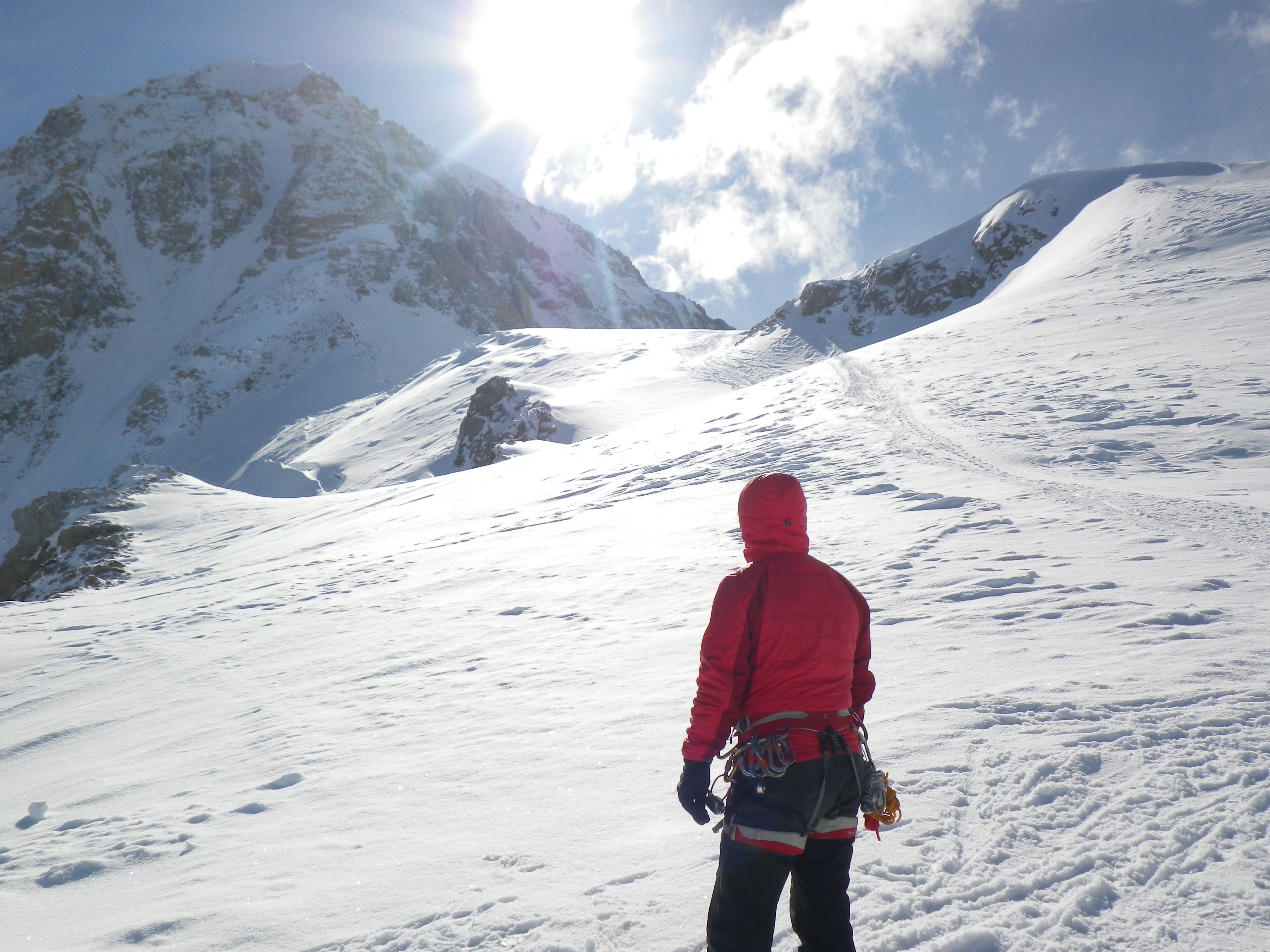
Looking up Squirrel Hill from the top of Motorcycle Hill on one of our acclimatization and cache days to Camp 14.

RIMG1077

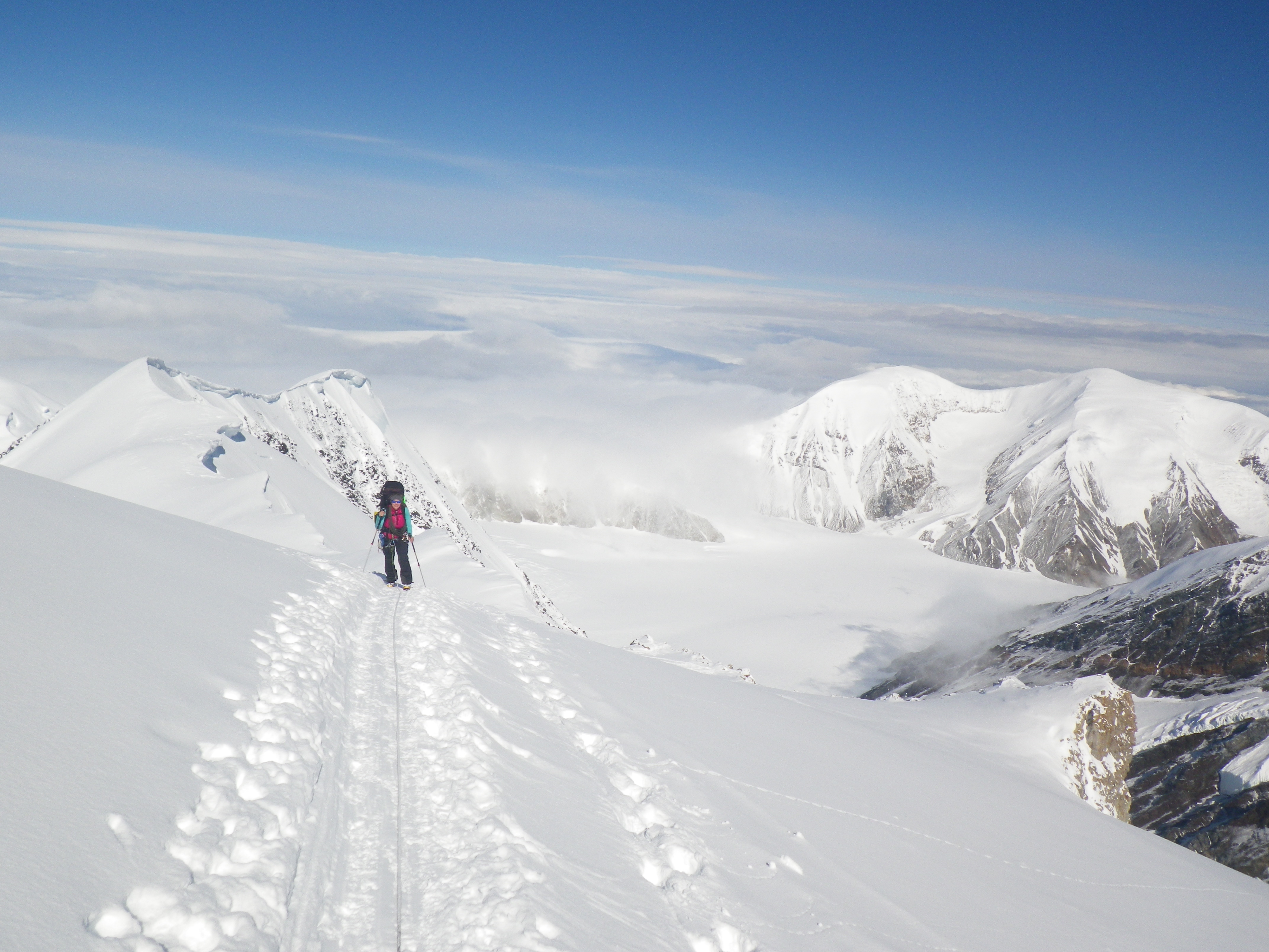
Kristin moving up Squirrel Hill with Peters Dome (back right) and Peters Glacier (below right).

RIMG1020

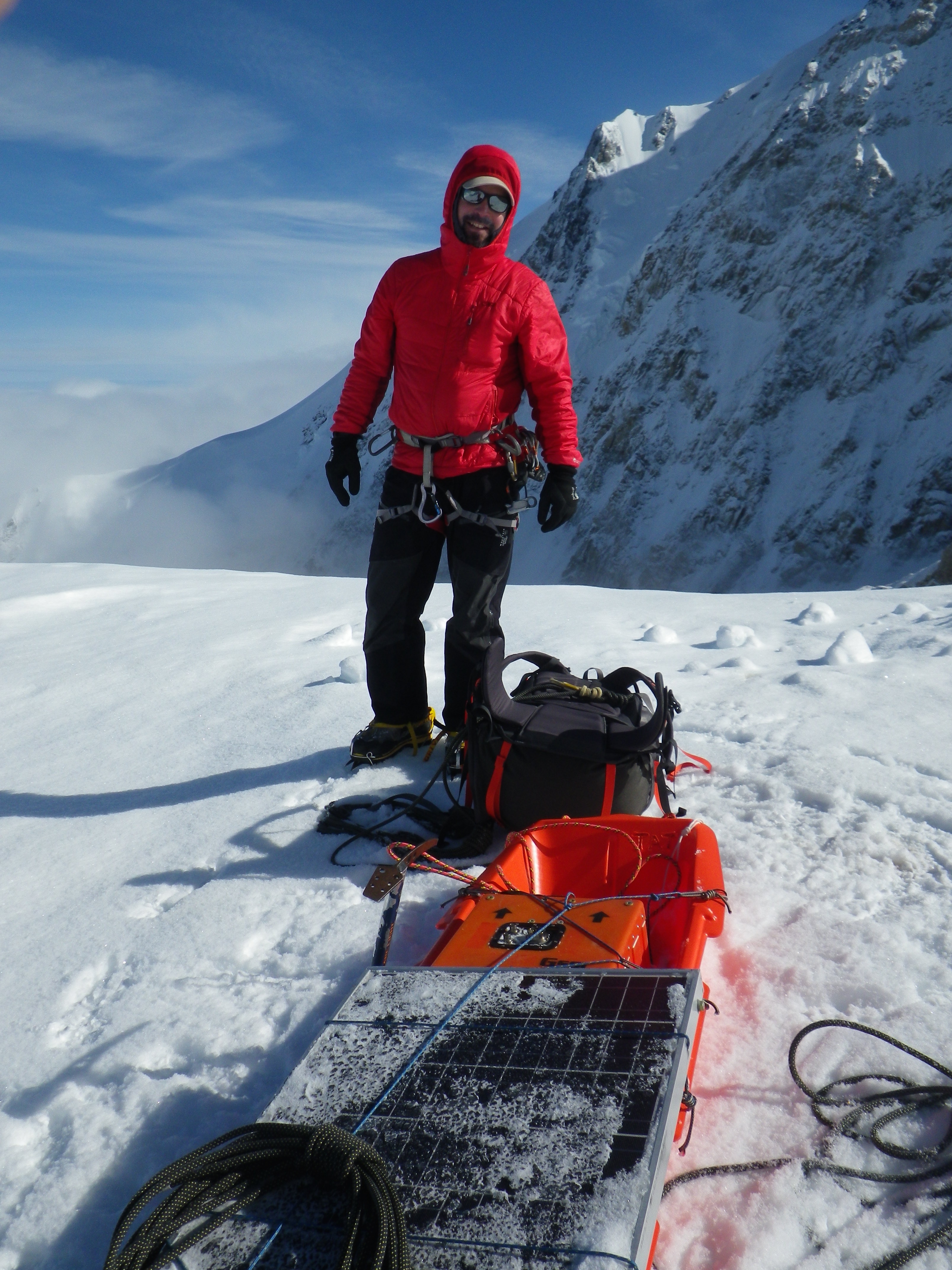
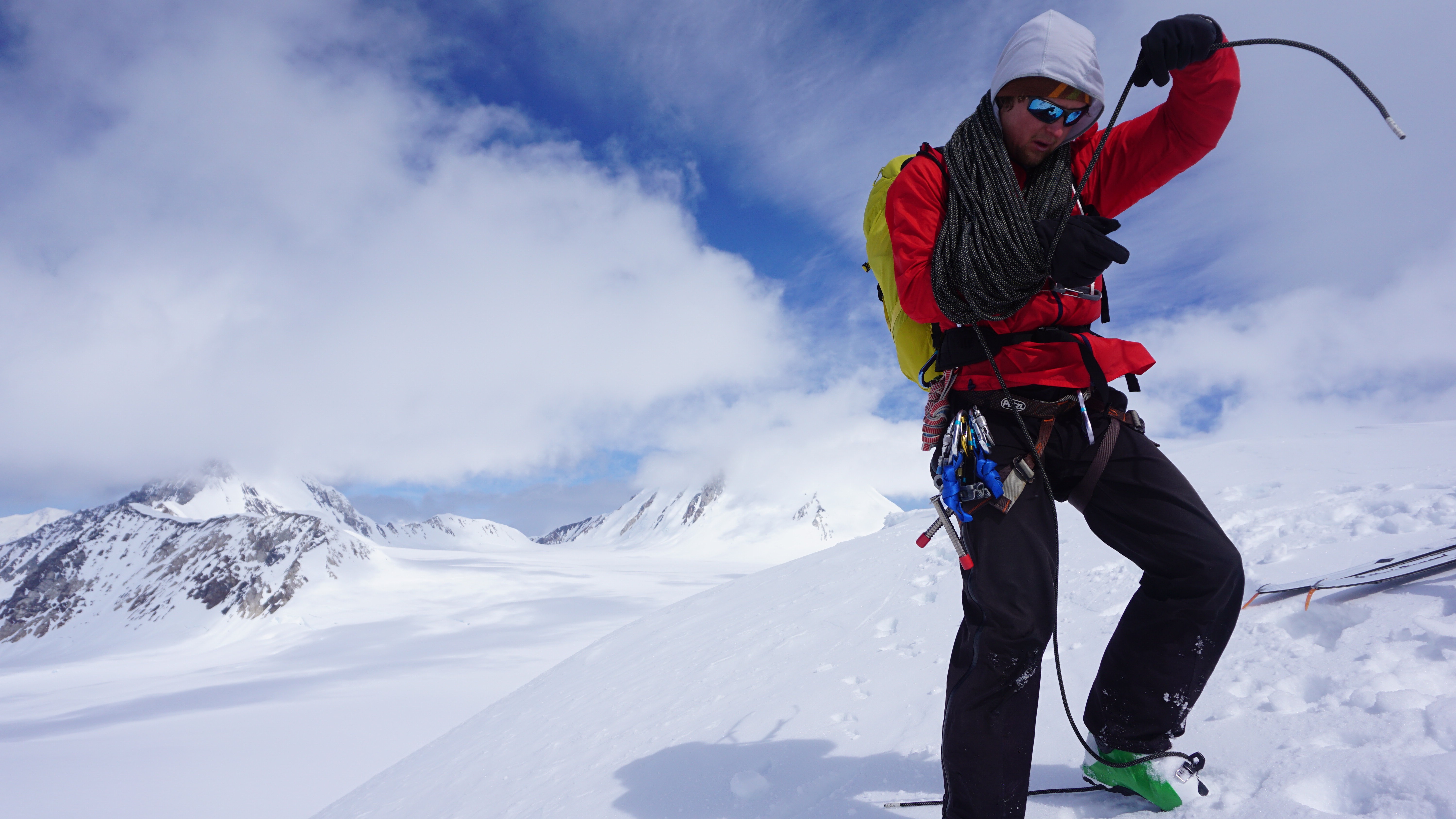
Me at the top of Motorcycle Hill (12000 fasl) towing the radar gear and solar power panel with a duffel full of food under the panel.  We left the panel at Windy Corner with the GPS base station, thankfully!

On the same day that Blaine and Kristin installed the USGS survey marker at Windy Corner, Patrick and I shuttled a huge amount of science gear, food, and supplies to 14,200 fasl from the 11,000 fasl camp.  Kristin and Blaine joined us at Camp 14 with some extra supplies after they finished the survey marker installation.  We returned to Camp 11 for the evening, and on the following day, moved the rest of our gear, camp, and ourselves to Camp 14.

IMG_3014

The duffel of food and a couple containers of fuel!

RIMG1087

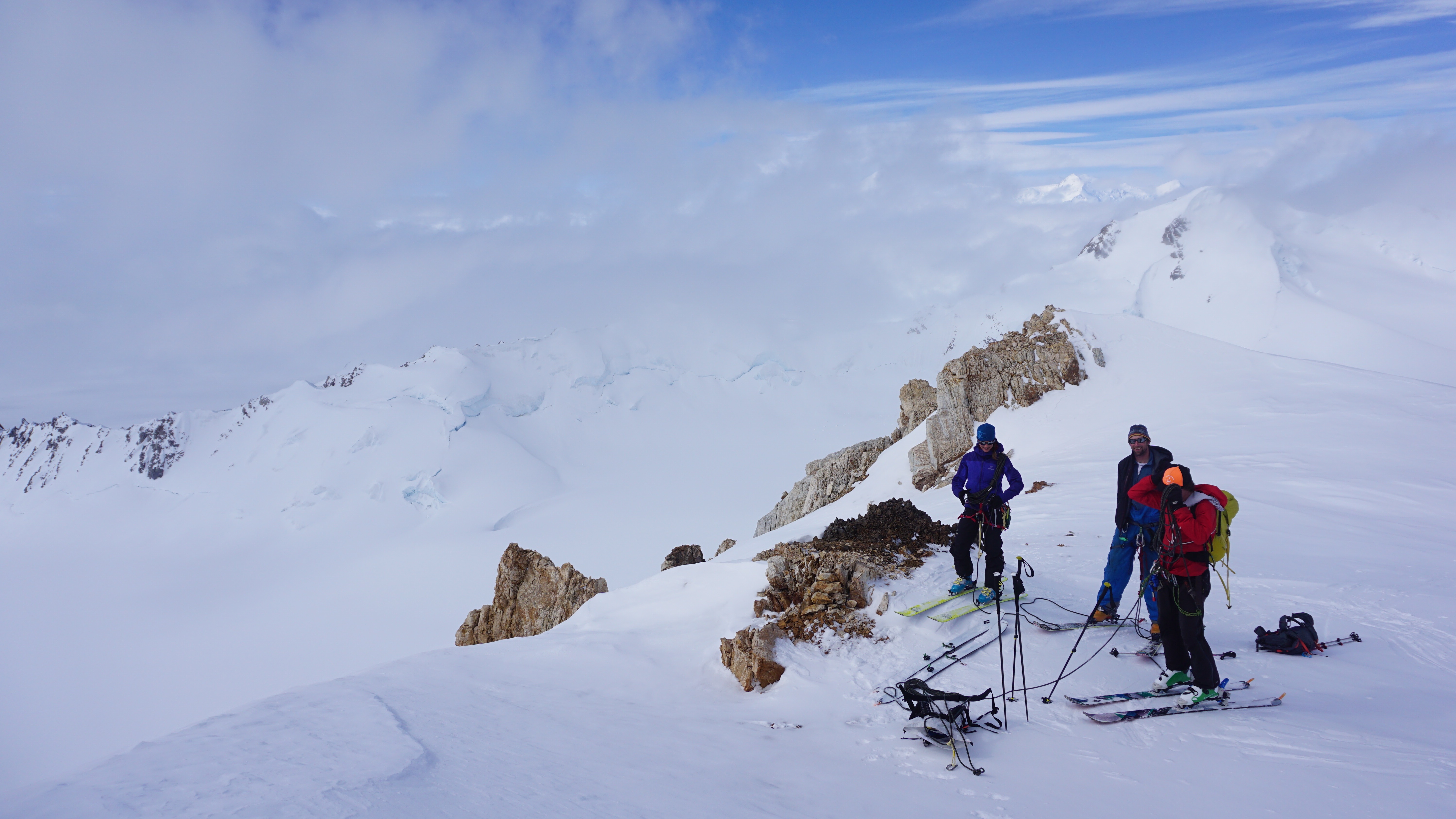
The team at a possible cache site above windy corner and below Camp 14.  We cached our gear at Camp 14 to cut a day out of our travel efforts so we could relax and rest a little more!

Once our entire team arrived at Camp 14, we settled in and started shuttling gear to higher cache sites the following day; first from Camp 14 to 16,400 fasl and a second beautiful day hike from Camp 14 to high camp at 17,300 fasl.  These two shuttle days helped us stage all our gear for a summit attempt and to acclimatize properly at higher elevations.  We then had some relaxing rest days at Camp 14 because of poor weather and also because we needed to trouble-shoot a few technical difficulties.  The cold temperatures were a little rough on some of the GPS cables, but after troubleshooting the cable issues (with assistance from the great park climbing rangers) we were able to get our GPS and GPR equipment all working properly.  We then installed the GPS base station over the USGS survey marker at Windy Corner with a 20-pound solar power panel, that we also hand carried up to the corner from base camp.  We hoped to record at least 48 hours of GPS data over the new survey marker as a first year of data for comparison to future years.

RIMG1098

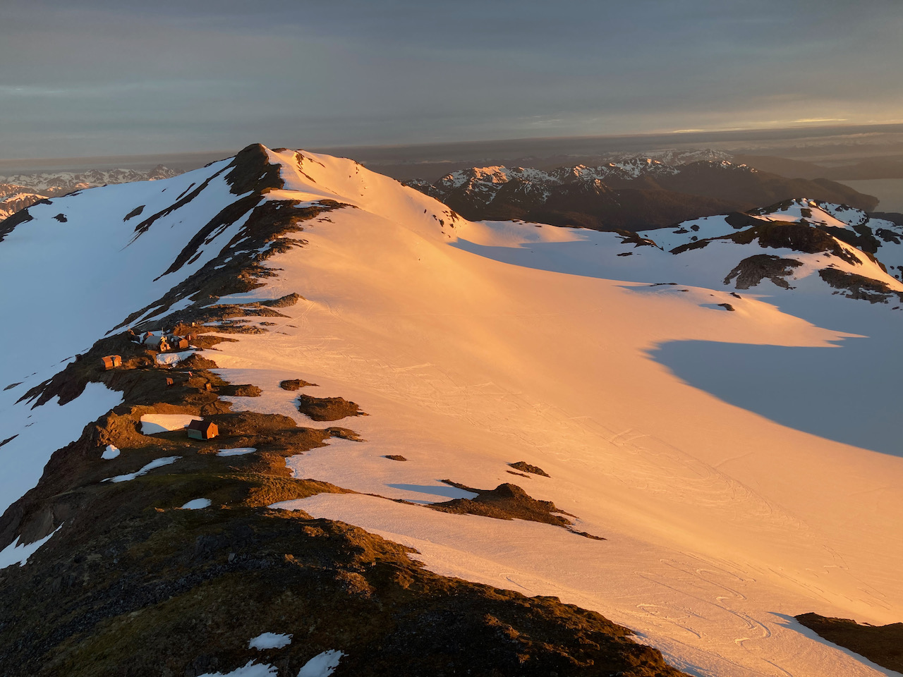
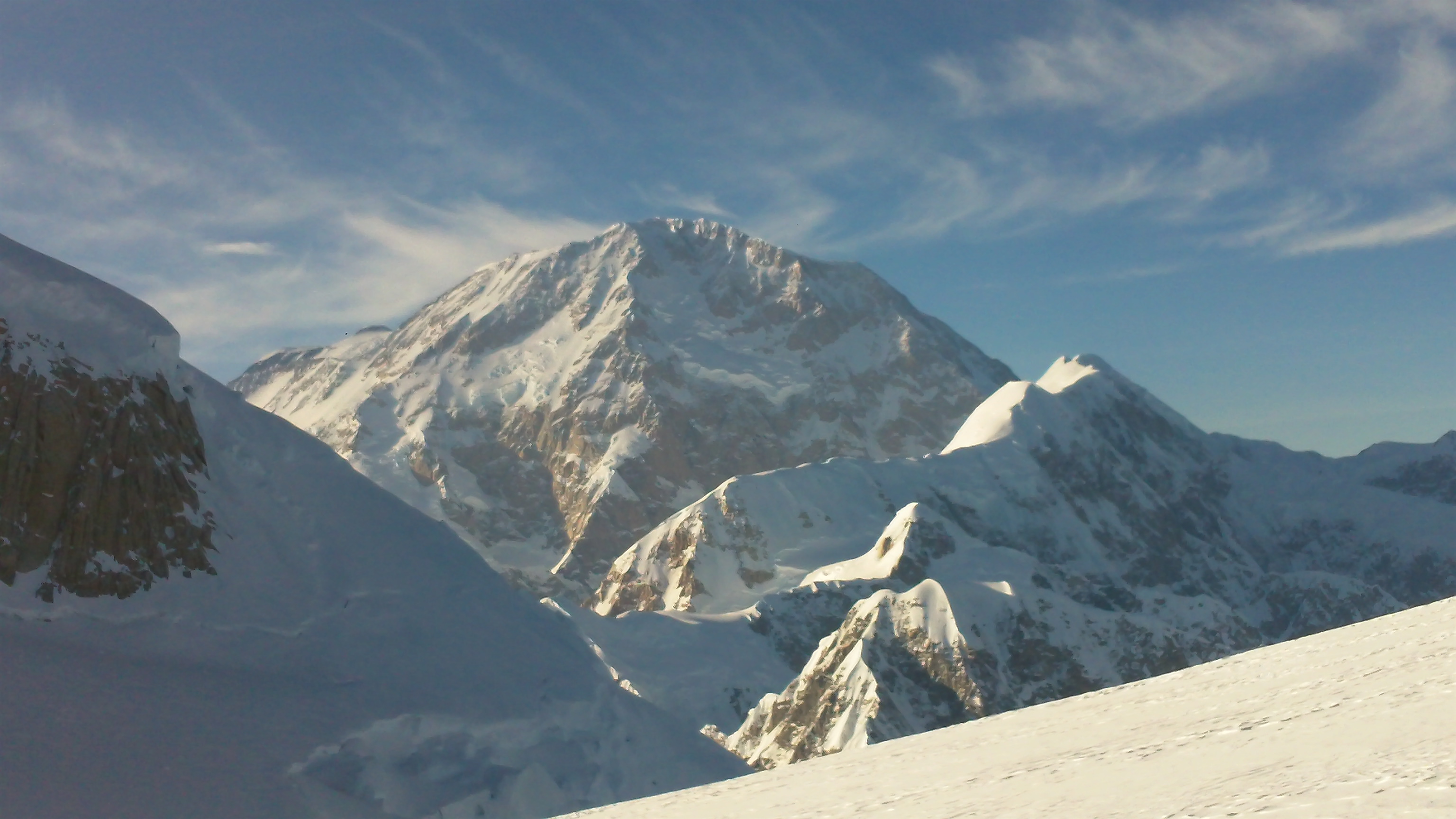
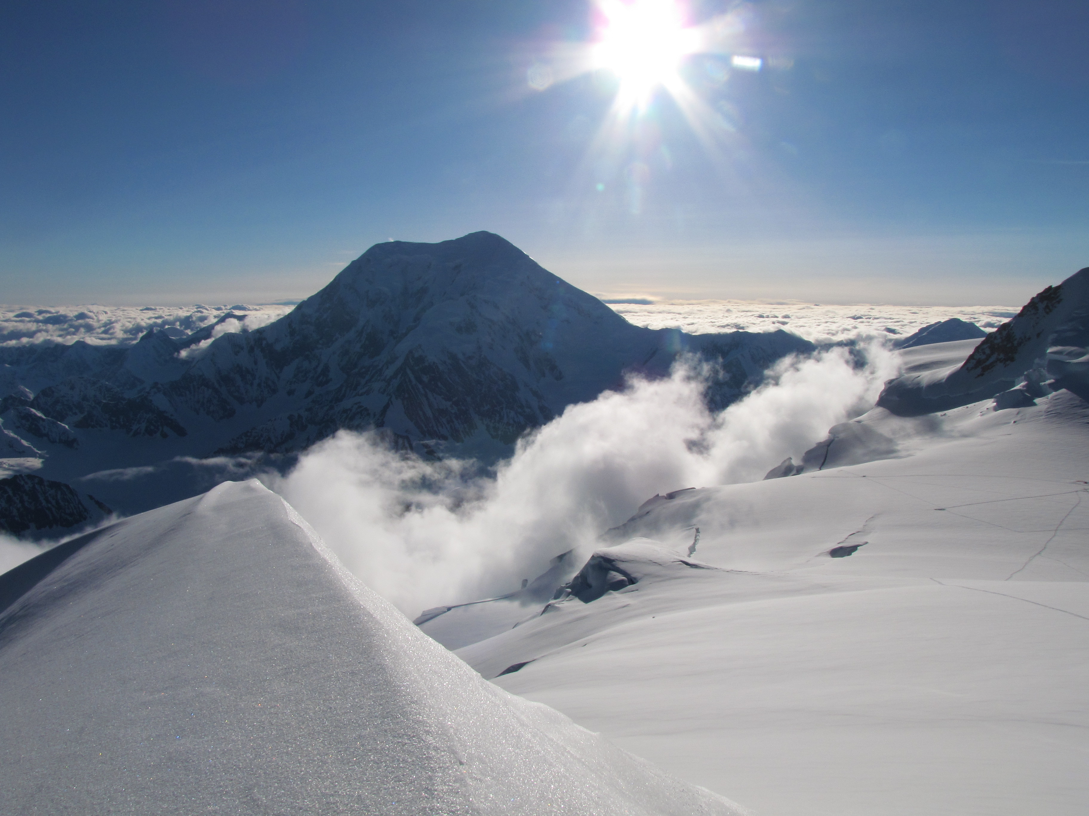
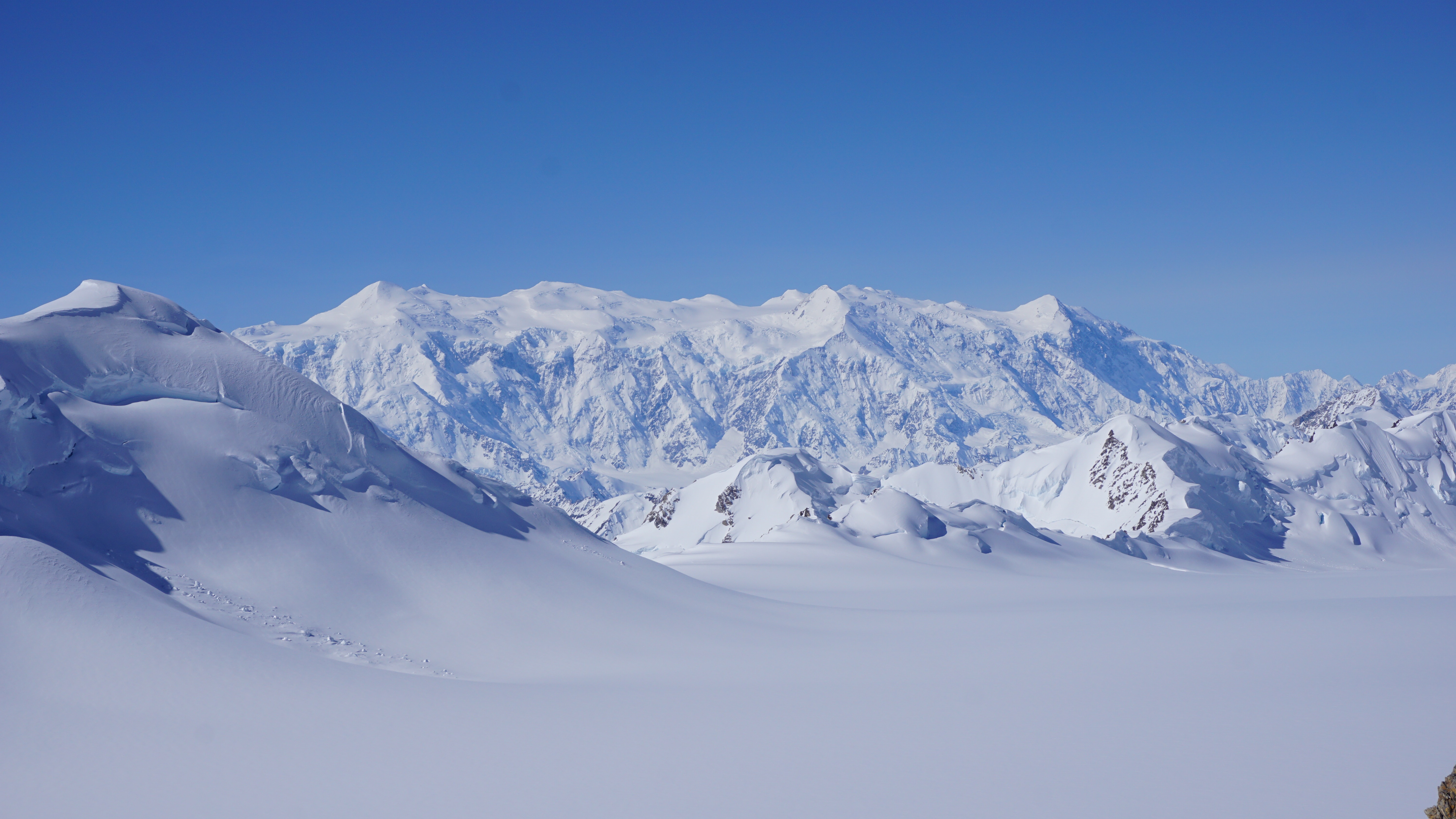
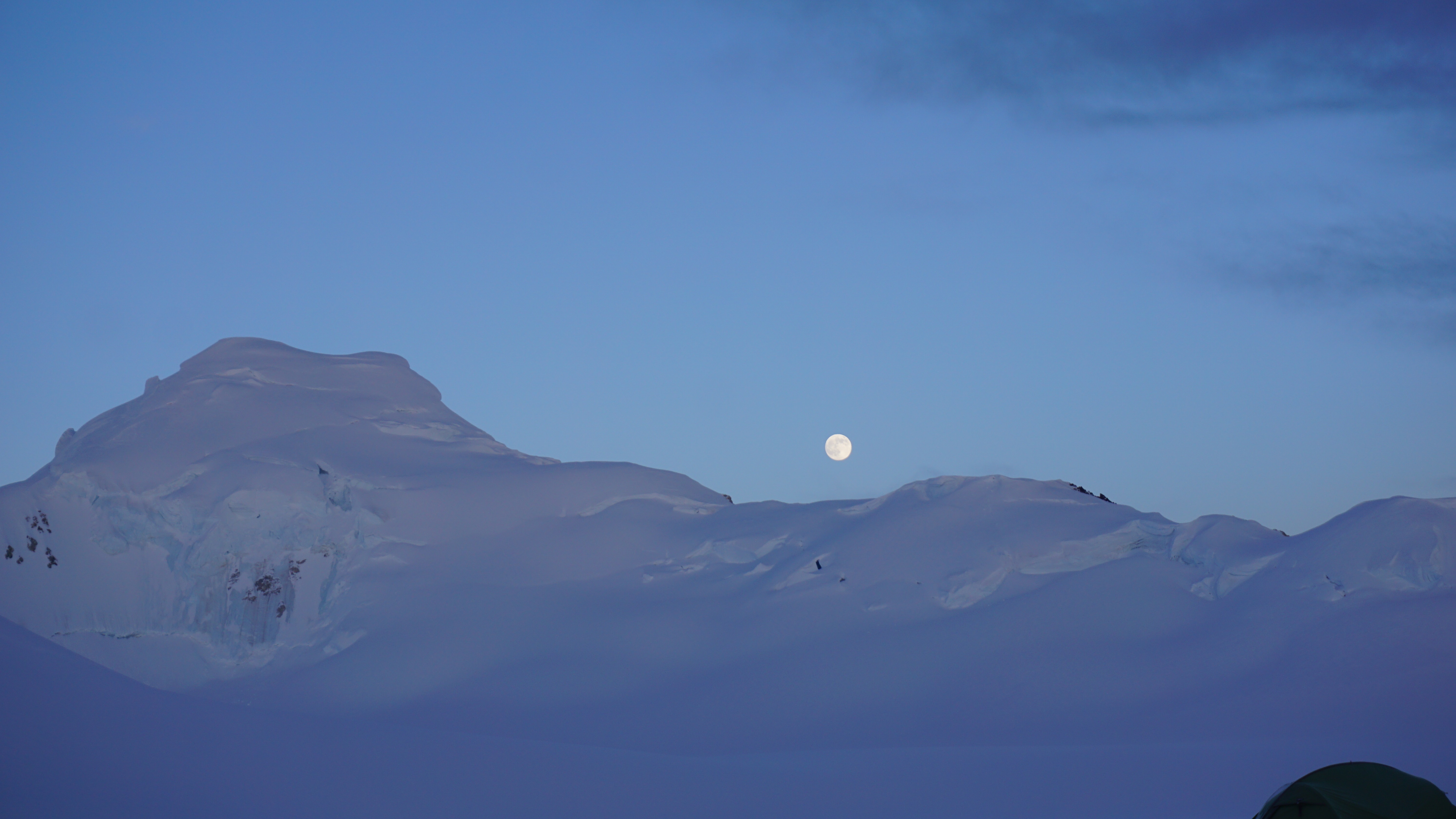
Evening view from Camp 14!  Mount Foraker (right) Hunter (left) and the moon…. BEAUTIFUL!

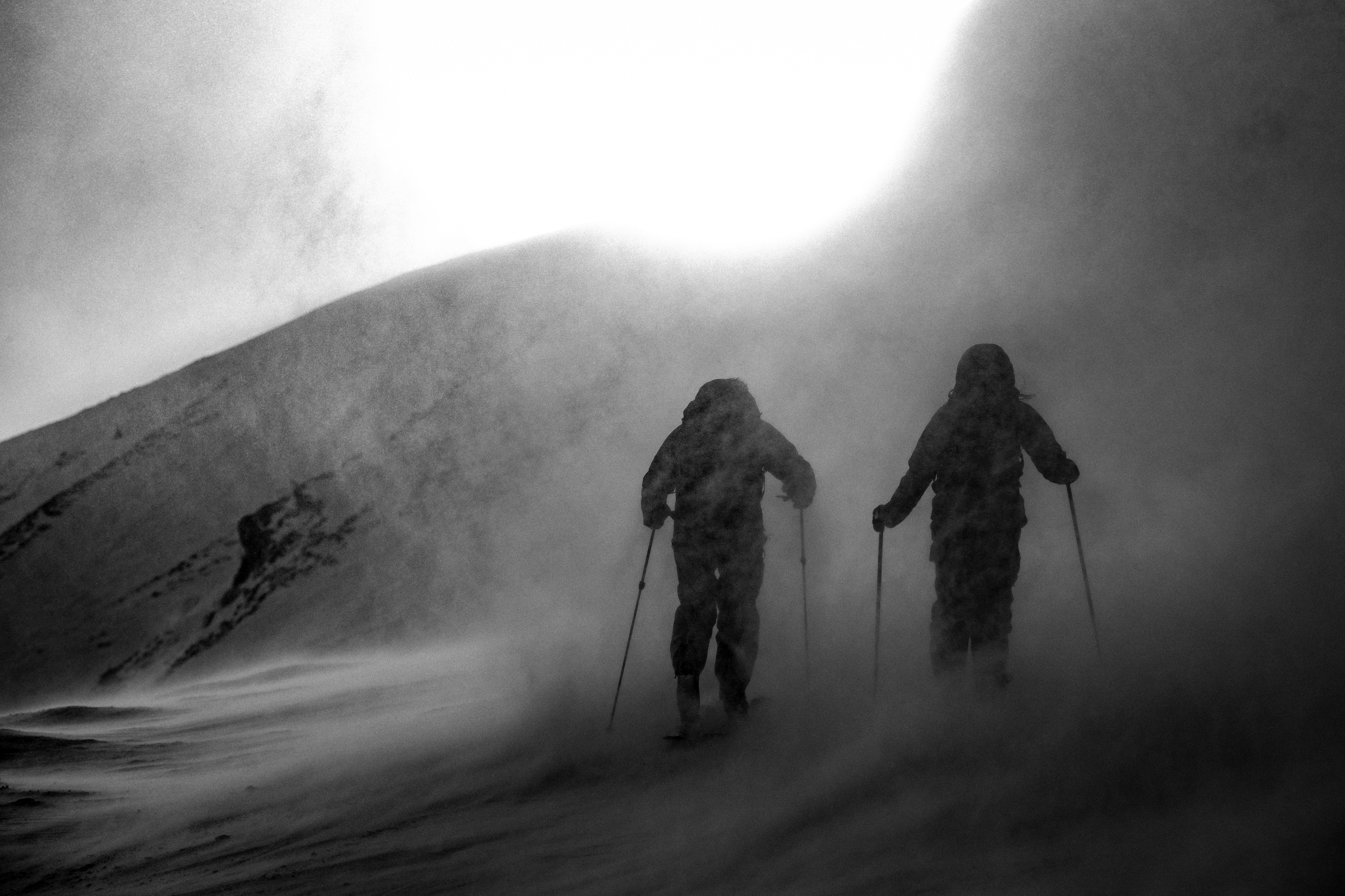
During our stormy weather at Camp 14 (which was relatively mild), Camp 17 received sustained 80 mph winds over the course of one day and up to 50-60 mph winds during the other storm days.  We were happy that we decided to wait out the storm at lower elevation once we heard that news!  After three days of rest at Camp 14 due to the weather and equipment issues, we had a great weather opening to climb towards high camp.

RIMG1138

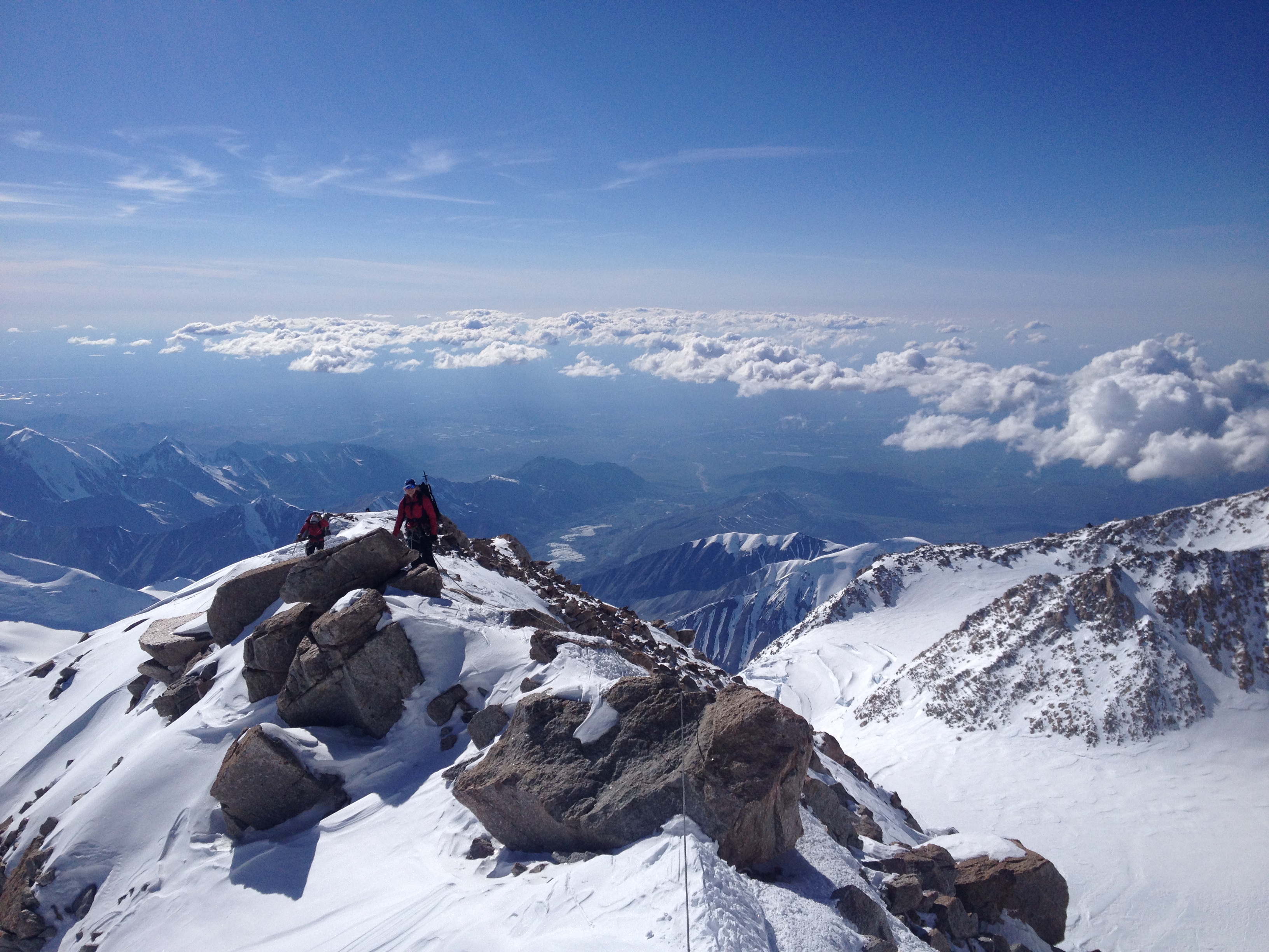
Climbing past Washburn’s Thumb about 16800 fasl on the West Buttress of Denali.  Coolest part of the climb we all agree!

IMG_2966

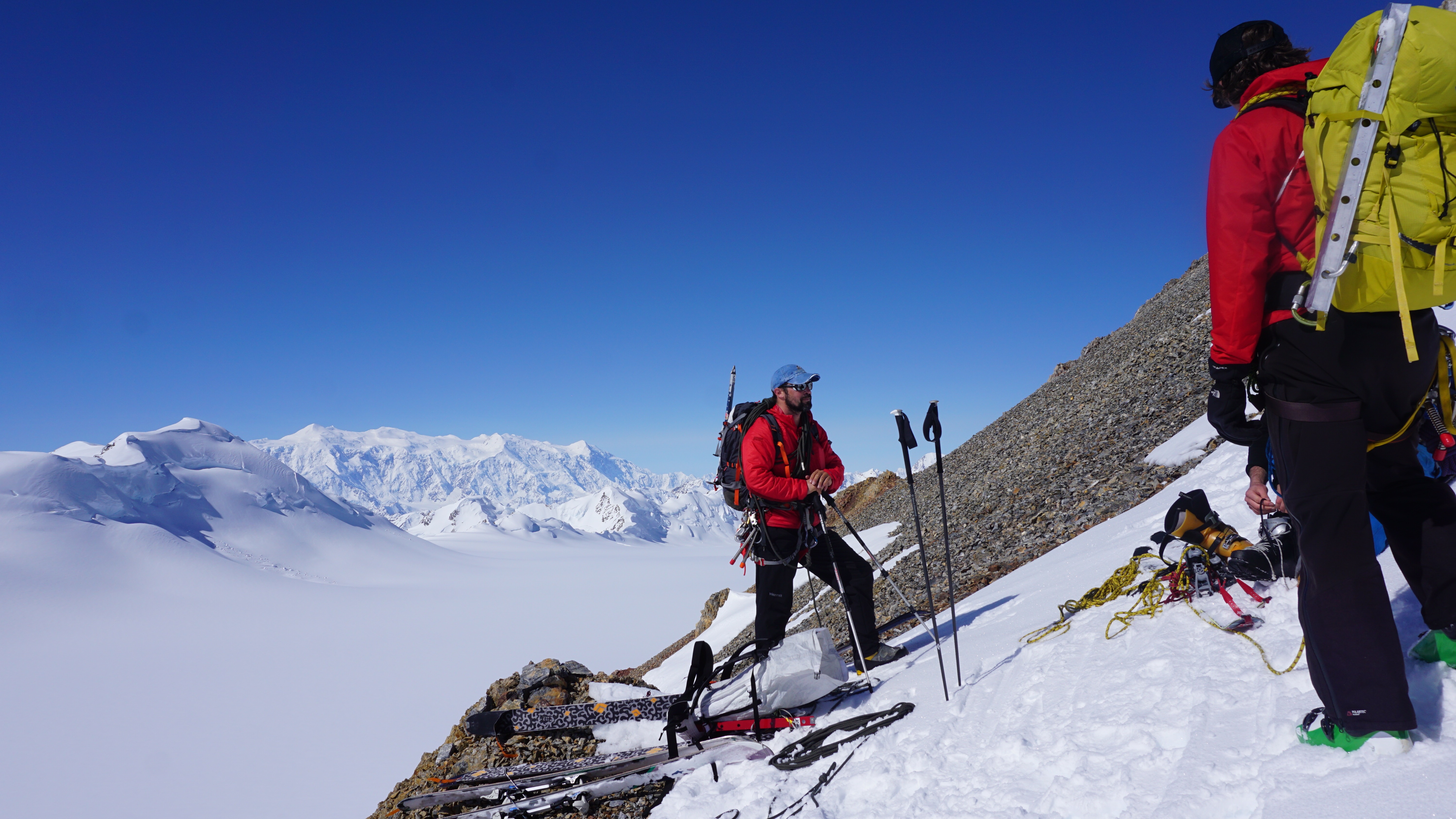
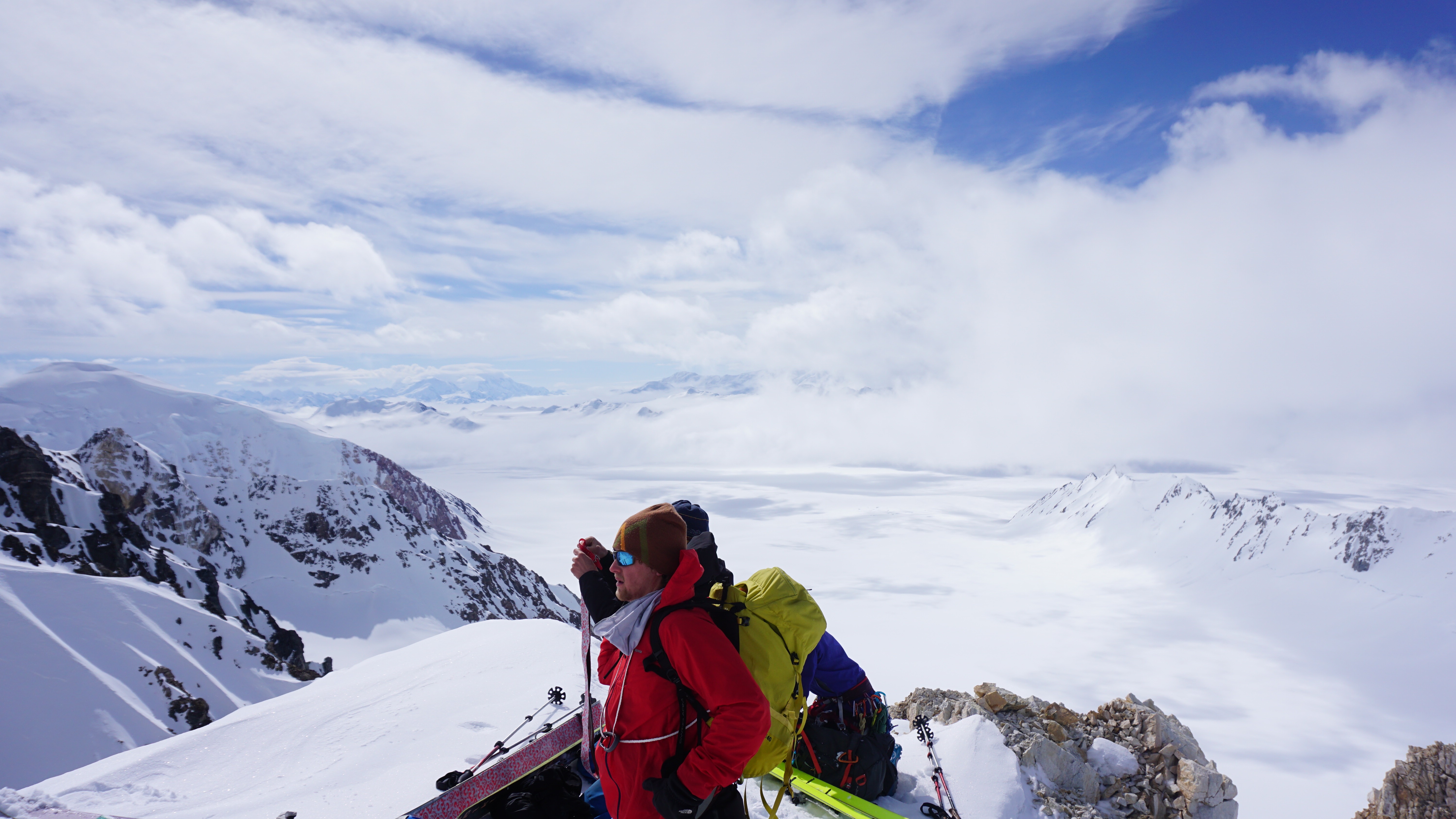
Patrick (left) and Kristin (right) on the awesome ridge between Camp 14 and Camp 17!

IMG_2962

Another amazing ridge view!

IMG_2963

And another!

One of the comical decisions of the trip was regarding our tent decision for high camp.  During the climb to Camp 14, we had used two The North Face VE-25 tents for sleeping quarters and a Hilleberg as a cook tent: plenty of room for four people.  BUT, to save weight and account for the added scientific gear weight, we decided to cut down on tents and bring only a single VE-25 tent for the four of us to sleep in.  Needless to say, the tent was plenty warm due to the crammed bodies packed inside the tent at high camp!

IMG_6716

Four of us squeezed in our VE-25 Tent at High camp! We were definitely warm enough!  (photo: Blaine Horner)

We had a few more days of poor weather at high camp while waiting for a summit bid.  In fact, we were not optimistic after two days of poor weather reports, unfortunately.  However, one thing about mountains is that the weather reports change almost as often as the weather.  After three days of waiting at high camp (with only one book to read between the four of us… Blaine wouldn’t read to us from it either!), we finally had a good weather report (or at least reasonable report) for the morning.

RIMG1133

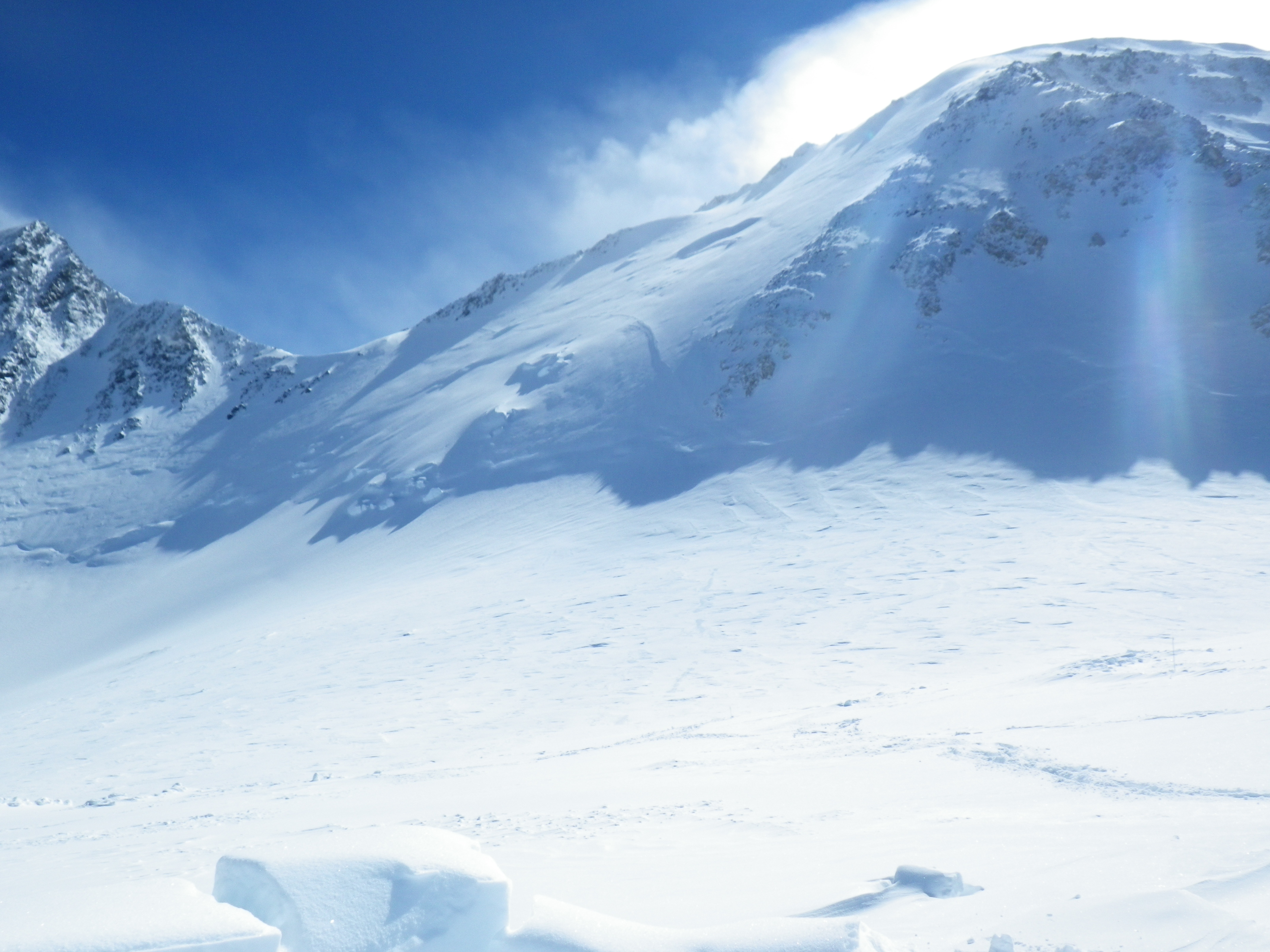
Looking up at the Autobahn which traverses up to the low point in the skyline, left of center.  Wind and clouds at the summit on this day;  We waited another day to climb to the summit.  It was less windy (but still windy), snowing and more clouds unfortunately!

On June 23, we woke to relatively calm conditions at high camp, but cloudy conditions up high.  Hoping it would clear up and deciding this was our weather chance to make the summit, we headed up the hill, first tackling the Autobahn, a well-known and treacherous portion of the route on a steep and icy slope that gains almost 1,500 feet of elevation from high camp to Denali Pass.  Patrick and Blaine started out in front of Kristin and I, two rope teams in teams of two.  We all reached Denali Pass relatively quickly but here is where the day became more interesting.  Upon our arrival at Denali Pass, we found another team who had attempted to summit the day before.  It turns out they had an accident that evening prior and one of their team members suffered a potential head injury.  Following some discussion, the decision was made for Blaine to help these two stranded climbers down to high camp while I led Kristin and Patrick upward for our summit attempt.  Blaine passed along his extra science gear to Patrick (which is how Patrick ended up with two heavy pieces of equipment) and we slowly started working our way up the hill in the fresh snowfall, wind, and in and out of the passing clouds.

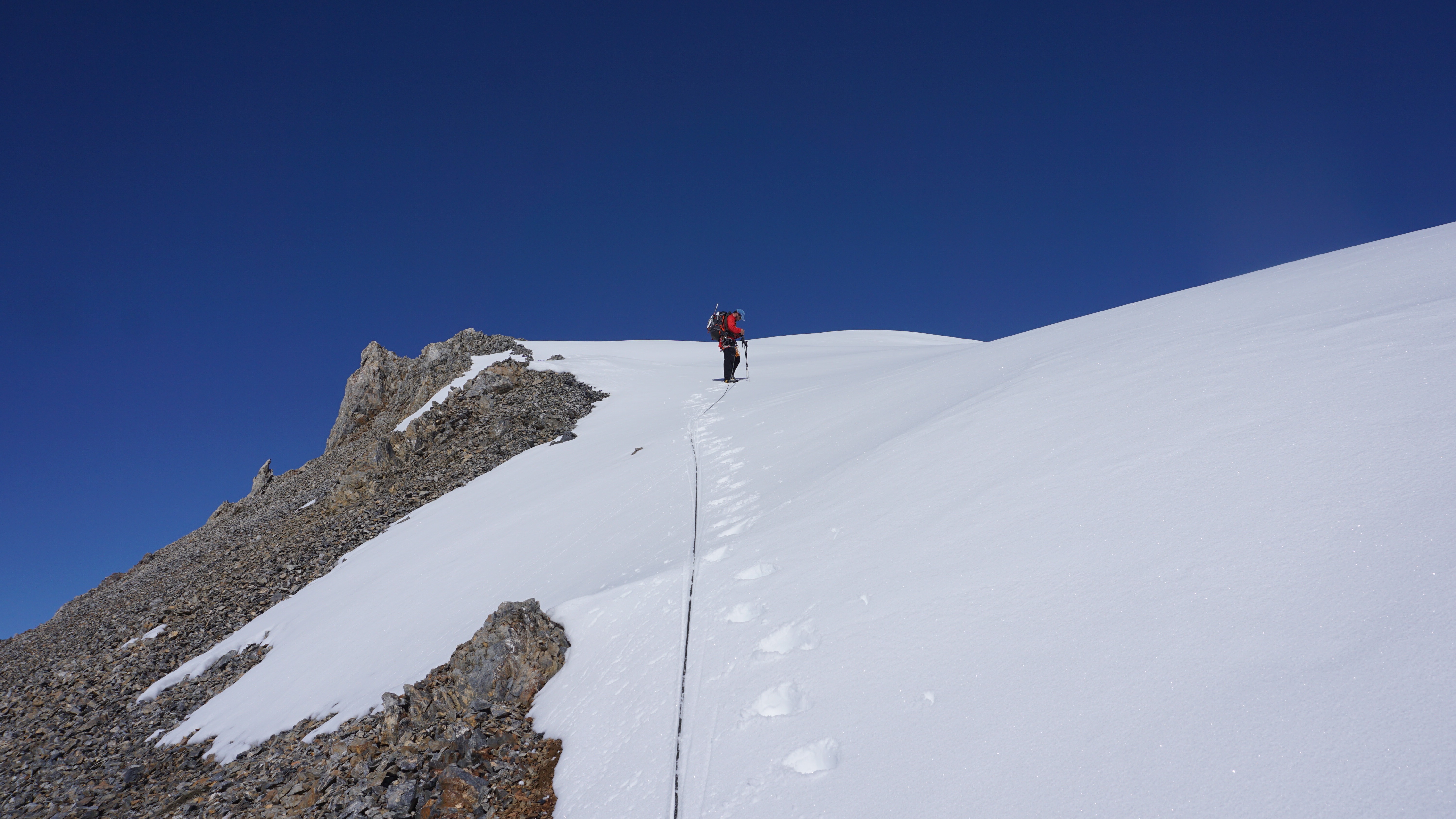
We also passed another large guided party at Denali pass making our team the first roped team of the day to push forward towards the summit.  Three solo climbers (no ropes) bounced in front of us, which we were quite happy with because they helped blaze a trail forward in the fresh powder snow which is exhausting to break trail in at over 18,000 feet!  Our climb to the summit was slow, steady, and honestly relatively uneventful (which is a good thing!).  We consistently checked on each other for warmth, comfort, and pace.  Our slow and steady pace found us on the summit ridge within a few hours of departing Denali Pass.  Unfortunately, the weather never really cleared up on the summit ridge.  For those of you who live in the northeast U.S.A., it was basically like a good cloudy day in the Presidential Range of the White Mountains in New Hampshire: windy, cold, snowy, but all were manageable with a slow pace and focus on our health and comfort through the entire day.  We reached the summit about 10 minutes before any other guided parties or roped teams reached it.  At the summit we didn’t waste much time checking out the scenery because we really couldn’t see any!  Kristin likens the view to the inside of a snowball. We were all pretty exhausted from the equipment haul as well, so we just set to work on our goal: to measure ice thickness with radar.  Kristin, Patrick, and I combined the radar equipment into my pack, linked all the cables and batteries together, AND VOILA!!! The radar turned on, the GPS synced with the radar, and we were in business. This is not to say that we expected the system NOT to work, it’s only that in all of our collective experiences working in the field, it’s usually never easy, works right the first time, or something goes wrong!  We were pretty psyched to get the system up and running on the first try.  Unfortunately, the one thing that DID go wrong during our time on the summit is the arrival of other summit teams as soon as we got the radar system up and running. This meant that we had a limited amount of time or access to the summit because others surrounded the summit upon their successive arrivals.  We completed three radar transects while near the summit: one from below and up to the summit marker, a second from the summit marker down slope, and a third that started down slope of the summit and traversed up and over the summit down a short portion of the West Buttress route.  After 20-30 minutes we finished our survey work, snapped some photos of us at the summit, and were ready to head down.  We were all tired and ready to make it back to camp but had several hours of slow downhill traverses to reach our comfortable sleeping bags.

RIMG1125

Myself, Kristin, and Patrick at the summit of Denali.  Not much of a view today unfortunately!


RIMG1111

Collecting radar data at the exact summit of Denali!

RIMG1105
Setting up the GPR at the summit of Denali!

We returned to high camp around 9:30 pm after summiting, about 13 hours from start to finish: not a HUGE day by mountain standards but long enough to look forward to a good night’s rest. We made several rounds of water on the MSR stove, had a ramen and mashed potato dinner, and were curled into bed by midnight. The following morning, we were packing by 9:30 am, ready to make a long 14-mile, (10,000 foot elevation change) push back to base camp.  We had another beautiful but climber-packed traverse from high camp down to Camp 14, arriving there around 3 pm.  This traverse section of the route is our collective favorite part of the West Buttress climb due to the steepness of the ridge and amazing scenery.  At Camp 14 we decided to take a mini-break to let temperatures cool down.  We dug up our cache of gear, and spent a few hours lounging around in the sun.  At 7 pm we started down the hill hoping to make it to Camp 11 within 3 hours.  It was beautiful to Windy Corner, but at the top of Squirrel Hill we were met by white out and snowy conditions which persisted the rest of the way to Camp 1.  But, temperatures were comfortable and we were all feeling pretty good.  Kristin and I left Camp 14 first with Patrick and Blaine following about an hour behind.  They traveled on skis making their descent more speedy and efficient than ours (our skis were cached at Camp 11). With the time differential, we all arrived at Camp 11 within 10 minutes of each other.

At Camp 11, we dug up our last buried cache, ate some smoked salmon and other snacks, and Blaine linked up with a friend who was kind enough to melt us some more water to save us time.  Blaine and Patrick again relaxed for a little longer while Kristin and I started slowly down the hill in the whiteout, traveling wand to wand with hopes of reaching camp 1 in another 3-4 hours.  Travel conditions were fairly atrocious on this leg of the route, unfortunately.  With a thin crust of ice over water-saturated snow caused by warm temperatures, whiteout and snowy conditions making for poor visibility, and our tired selves, Kristin and I decided skiing was not a safe option.  Unfortunately, with the skis off, the poor snow conditions caused us to post-hole slowly down the hill (post-holing means sinking into the snow up to our thighs upon every step).  Despite sinking into the snowpack, we decided the personal control and ability to keep our rope tight between us while traveling on this potentially crevasse ridden region of the route, was more important than traveling faster (as in on skis).  The talented skiers on our team (Blaine and Patrick!) were able to negotiate the route on skis, but skiing skill DEFINITELY played a role in their rapid successful descent!

RIMG1157

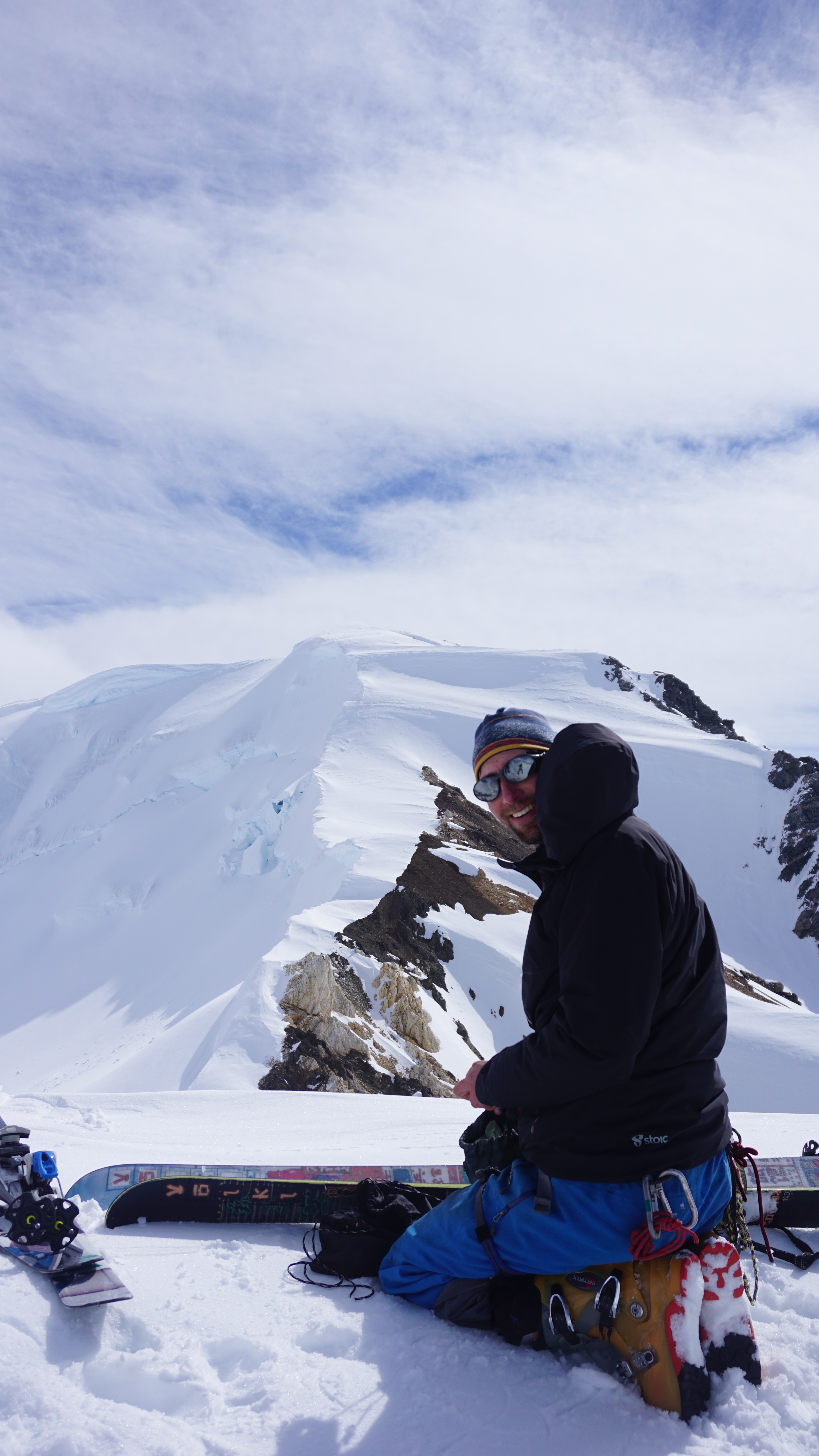
Resting at Camp 14 after the summit and decent from Camp 17

IMG_3015

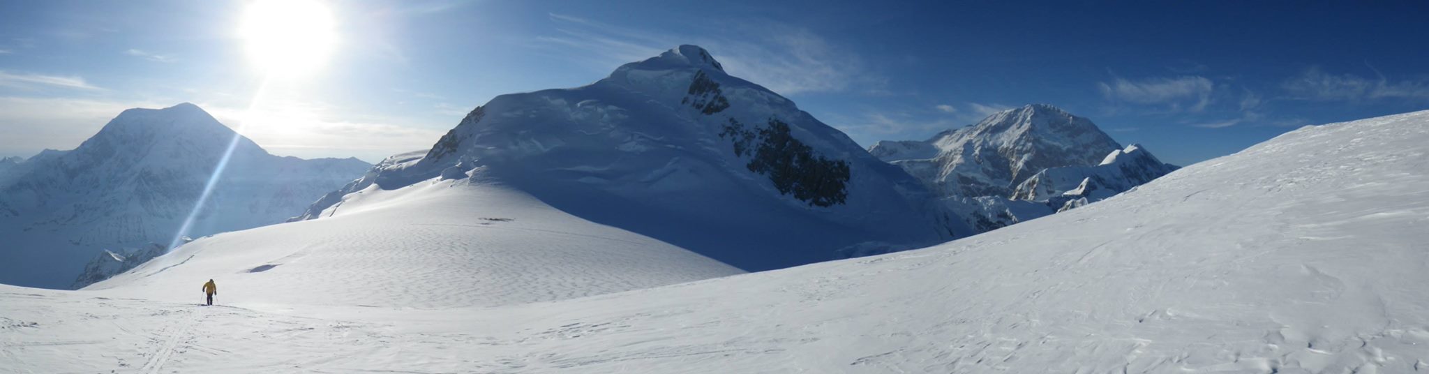
View during our rest at Camp 14!

After a strenuous descent to Camp 1 arriving around 3 am, Kristin and I decided to set up camp for a few hours to get some rest.  We had been on the go since 10 am the prior morning with a few stops at each camp.  A little rest prior to completing the last 5.5-mile ski to basecamp would do us well!  During the rest stop, I brewed some more hot water, enough for a couple glasses of hot apple cider, and then we rested for a few hours.  I laid awake, listening to teams slowly trudge by us over the next couple hours.  It’s a common occurrence for teams to “death march” from the summit back to base camp over 24-48 hours- a continuous push without setting up a camp and sleeping.  Most of the teams that summited with us on June 23 were trying to do just that, each resting at various locations along the descent.  After three hours, Kristin and I were ready to go again.  After 30 minutes, we were packed up and had our skis on for the final trek back to basecamp.  We arrived into basecamp after a relatively uneventful ski, around 10:20 am, over 24 hours since we departed high camp the day before and less than 40 hours from our successful summit of Denali.  After a relaxing hour wait at basecamp we were on a flight back to town with Talkeetna Air Taxi.

Upon arriving in town, a shower, full pizza and calzone, ice cream, and relaxing on the town green was all in order.  Great end to a successful field season.  In a few months time (once we process data), we will distribute results of our field effort so folks can learn more about the science we accomplished this year.  Overall, a fantastic team, a fantastic effort, great support from TAT, the park service, Compass Data, USGS, and a very enjoyable field season!  Enjoy the many photos!

IMG_3056

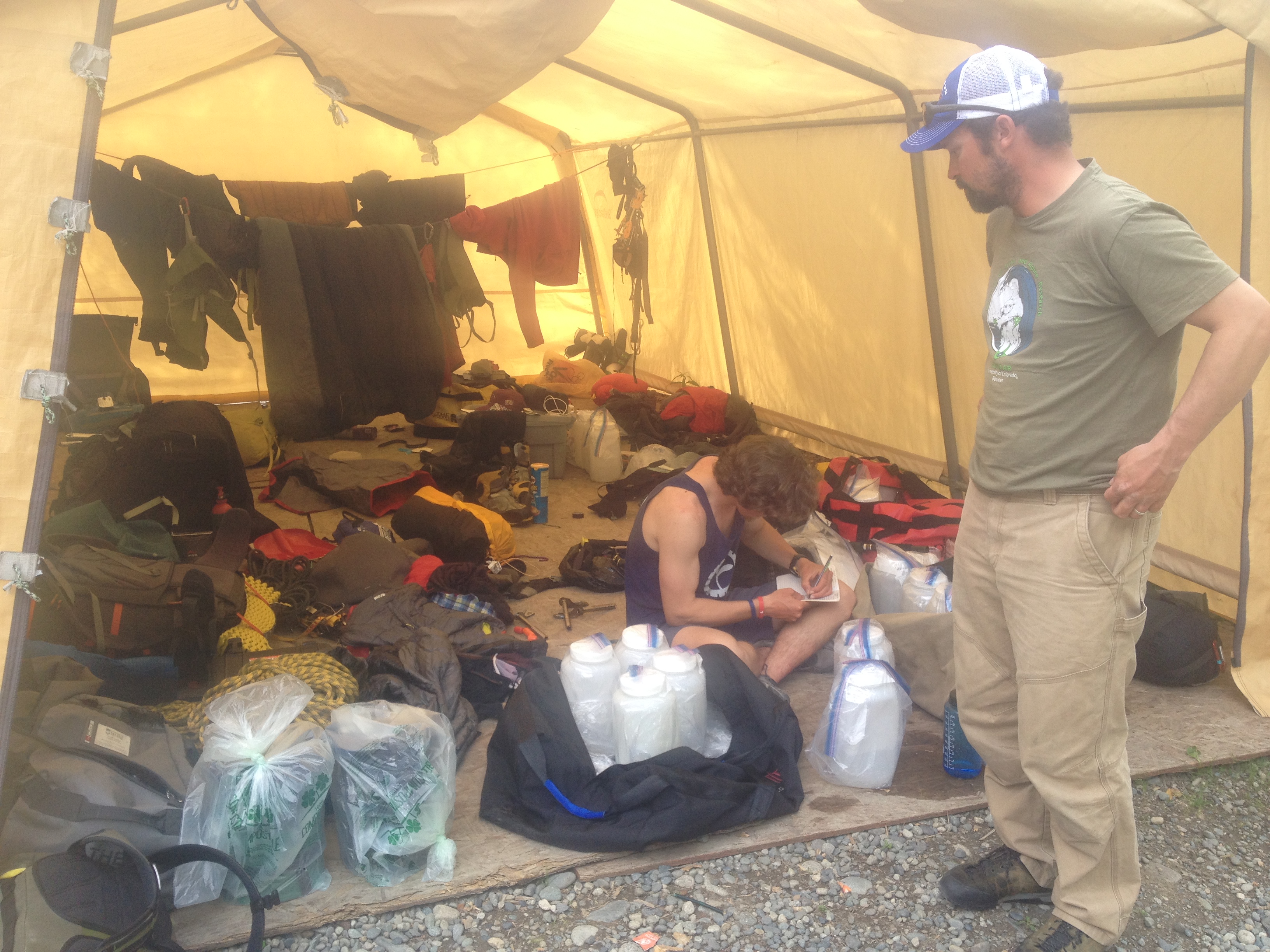
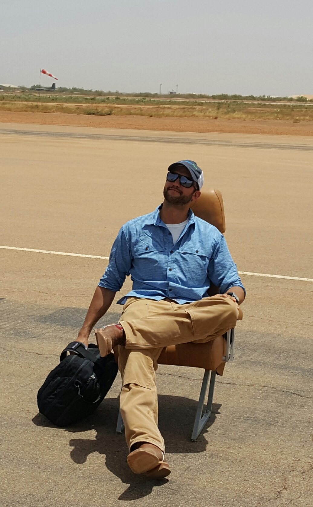
Drying equipment and gear out back at Talkeetna Air Taxi in Talkeetna….  my pants no longer stay up after loosing about 14 pounds over this last 2 months on Denali and by Mount Logan!


Heading to the Mountain!

Hi all,

Quick note to let folks know that we will be heading to the mountain today, WE THINK!  We are having breakfast at our favorite morning food stop, the Talkeetna Roadhouse, and then heading back to TAT for check in.  Weather is looking pretty nice in Talkeetna but my phone radar app shows some clouds over the mountains.  Time will tell what our friends at base camp call in for a weather report.  Fingers crossed!

IMG_2917

The Talkeetna Roadhouse! If you visit this place, they have amazing Sourdough Pancakes with lots of blueberries and blackberries!    

Remember to follow along on my homepage at https://alpinesciences.net/ where my Twitter updates will display while we are in the field!  I am using my Delorme In Reach to send short updates to my Twitter, Facebook, and website pages simultaneously.  Each message I send will link to a map showing exactly where we are located on the West Buttress climbing route so we hope you follow along!  With a little bit of luck, patience, and perseverance, the next large BLOG I post will be back in Town Talkeetna after a successful field season! Cheers!

Picture3

Reminder of the route we will be climbing and primary locations we will be studying enroute up Denali, starting in a few short hours!

A DAY “OFF” IN TALKEETNA

We arrived safe and sound in Talkeetna, Alaska around 9:30 pm on Saturday evening.  We popped over to Talkeetna Air Taxi (TAT) to check on some missing shipped gear that we need for our field work (TAT was closed by the time we arrived), snagged a hotel room at the Swiss Alaska Inn, and then bounced downtown to visit some climbing friends at the local evening hangout, Fairview Inn.  Blaine was able to meet up with colleagues he hadn’t seen in a couple years and we talked with them about current climbing route conditions, considering they just came off Denali.

IMG_2902

Kristin and I at TAT, Saturday evening

IMG_2901

Amazing Plane! The Otter…

On Sunday morning we ate breakfast at the Inn and checked in with TAT. They helped us locate three of our missing bags which just arrived yesterday in Talkeetna.  We are still missing two bags but they are the less important of the five total bags so it seems our project is now officially a go!  We talked for a bit with the great folks of TAT (including owner of TAT, friend, and long-time supporter of science research in Denali, Paul Roderick).

IMG_2904

Blaine (center) and Brian Wright (USGS-left) looking skeptical as I explain ground-penetrating radar for use in measuring snow and ice thicknesses.  Seriously, it works guys!

We then bounced over to the DNP Ranger Station for our briefing with park rangers.  Every climber that goes onto Denali needs to fill out climbing permit paperwork in advance of their climb (which we had). Upon arrival, every group meets with a ranger to discuss their climbing objectives and some other pertinent details.  For example, we let the rangers know the color of our tents, our emergency communication capabilities (we have a Delorme In-Reach and a satellite phone), our planned route, and proposed start/end dates for our time on the mountain.  The rangers also summarize current route conditions and any policies which are pertinent to our climb.

IMG_2909

Lots of climbers this year but not a very high success rate!  Usually its a 50% success rate, not 35%!

IMG_2908

That’s a big foot!

IMG_2905

The marker we are installing at Windy Corner

IMG_2907

A comparison of markers on display at the ranger station. Note the center marker and the sticker in the upper right hand corner.  Blaine and team from last year surveyed the Denali summit at 20,310 feet above sea level, 10 feet lower than previously thought.  Now everyone has to change the elevation listed on all their Denali-related memorabilia!

Considering we are one of over 1000 climbers who are registered to climb the West Buttress of Denali this year, the rangers provided a detailed summary of:

  • Where their rangers are located on-route right now;
  • Where and how we can cache gear and equipment along the route, that we don’t need for the entire climb;
  • Where we can dump human waste on the mountain;
  • What is required for all climbers to have when traveling to higher camps on Denali;
  • Recent weather events such as snowfall or wind that significantly influence the safety or condition of the route (i.e. avalanche hazards, wind slabs, icy route conditions, etc.).

Ironically, probably one of the most commonly asked question by non-climbers is about how we manage human waste in the field (i.e. how and where do you go the bathroom? What do you do with the human waste?).  SO, I’ll give you a little run-down here as it relates to the West Buttress climbing route.  The park staffs a seasonal ranger station (tent) at base camp (7,600 fasl) where you fly into the West Buttress and a second at 14,200 fasl.  Pit latrines have been established at both sites where climbers can go pee in a hole. However, climbers also use a lightweight and portable 10” diameter capped-PVC tube called a “clean mountain can” (CMC) to sit on like a 5-gallon bucket, for #2!  The park provides biodegradable bags to line each CMC which you fill to the brim before you pull the bag out and tie it off like a trash bag.  Certain crevasses (large cracks in the glacier ice) on the Kahiltna are approved dumping grounds for climbers to toss their biodegradable bags of human waste into, with the idea that over time it is biodegrade.  This said, the most conscientious and environmentally friendly climbers try to minimize leaving their waste on the mountain so they also have the option of transporting it out via plane at the end of their season.  High on the mountain where the slopes are mostly ice due to high winds scouring the glacier, all waste is required to be carried down the mountain to lower elevations.  It’s a pretty extensive and impressive leave-no-trace strategy considering climbers often stay on the mountain for 18-20 days per group.  Lots of research has actually gone into the current waste management plan.  For example, here is a link to a peer-reviewed paper by colleagues about waste management on the Kahiltna!

cimg0451

Clean Mountain Cans, ready to be used!

Another cool fact: Rangers patrol from base camp all the way to the summit and back to help answer climber questions, make sure climbers are following waste management (and other) regulations, and to be available in the event of an emergency which needs immediate attention (for example climbers who may have injuries from a fall, cold related injuries or illnesses such as frostbite or hypothermia, or high altitude illnesses).  Rangers on Denali are the backbone of the park and the climbing rangers are also a wealth of knowledge.  While at the ranger station, we bumped into a long-time ranger, now friend, and supporter of our science efforts, ranger Joe Reichert.  It’s always good to see the familiar faces in Talkeetna but Joe is one of those that has a tendency to stand out for both Blaine and I.  He is always positive, always has a smile on his face, and is ALWAYS psyched to chat about climbing, science, the park, or anything outdoors.  In reality, all of the rangers at Denali are similar to Joe in this manner so it’s always fun working alongside of them on the mountain.

IMG_2911

Joe Reichert with Kristin, myself and Blaine (left to right) in the Talkeetna Ranger Station

 After our ranger visit, we returned to TAT to organize and weigh all our gear which will be flown onto the mountain.  TAT (and any flight service provider for that matter) needs to know exact weights of everything so it’s a standard process to weigh every little piece of equipment.  With the organization and weighing of our gear out of the way, now we play the waiting game!

RIMG0943

Kristin weighing my skis and ski poles

Poor weather (snow and low clouds) has base camp socked in right now and it’s a down-pour in Talkeetna so it’s a no-fly day.  Will killed the rest of the day by eating pizza for lunch at Mountain High Pies (where we also ran into a friend and long-time pilot, Tony who showed us a cool video he recorded of sub-glacial melt water flowing out from under the vegetation-covered tongue of nearby Ruth Glacier), ice-cream at Nagley’s General Store, checking out various local artist shops, and walking down to the Susitna River.

RIMG0944

Nagley’s General store with a few other businesses.  Perhaps food at the West Rib may be in order today.  Check out their “Sewards Folly” burger.  4 pounds of meat in one burger!

At the Susitna, we realized that flying onto the glacier may be delayed for a few days, BUT, overall, it was a nice relaxing day yesterday to catch up on rest after the long travel day to arrive in Talkeetna.

Screenshot_2016-06-06-09-28-44

Where is the mountain?!  View last night across the Susitna River towards Denali… Maybe weather will improve tomorrow!

It’s raining this morning but that means breakfast at the Roadhouse.  They have amazing food in a comfortable family style atmosphere… Amazing black and blue (blueberries and blackberries) sourdough pancakes! Blaine, Kristin, and I just finished eating so now we wait and see what today brings!

RESEARCH ON DENALI: ‘THE GREAT ONE’

Yesterday, Kristin and I set off on a new exciting research adventure back to my old stomping grounds: Denali National Park and Preserve (DNP), Alaska.  2015 was the first in eight years that I had not returned to the wonderful town of Talkeetna, the hub of access to glaciers and mountains in DNP.  Talkeetna is one of my favorite towns in the country and for several years it turned into a summer home base for me.  Amazing people, wonderful businesses, caring community, all within walking distance of each other and a backdrop of the Alaska Mountain Range. Who could ask for more in an Alaska town?!

the highest mountain in DNP also happens to be the highest in North America at 20310 feet above sea level.  This peak was formerly known by U.S. citizens as Mount McKinley but its name was recently reverted back to one originally provided by natives of the area: “Denali” or “The Great One.”  It seems fitting that a place which is still wild, remote, and rugged by anyone’s classification, bears its original name.  Denali creates a trifecta view with two other large peaks in the area: Foraker (17,400 feet above sea level) and Hunter (14,573 feet above sea level). Native stories tell of Denali being the Father, Foraker being the mother, and Hunter being the child.  These three peaks create the ultimate backdrop to the town of Talkeetna when viewed across nearby Susitna River.

DCIM100SPORT

“The Great One” (Denali) viewed from Middle Hunter Peak on the flanks of Mount Hunter (photo by Karl Kreutz, 2013)

IMG_6791

Mount Foraker from the summit of the Middle Peak on Mount Hunter in 2013.  Note the snow covered valley on the right side of this photo is the ice divide that we collected two surface to bedrock ice cores from in 2013.  You can see some ski tracks in the photo where we collected ground penetrating radar ice depth measurements.

1073985_10101112775600629_263672860_o

The big three: Mount Foraker on the left, Mount Hunter in the middle, and Denali on the right in the back.  Just in the sun near the shadow of Hunter you can see a dark area in the snow.  That was the ice core drill site in 2013.

The first reported successful ascent of Denali was in 1913 by a group up the Muldrow and Harper Glaciers located on the North side of Denali.  In 1951 Bradford Washburn and his team forged their way up the Kahiltna Glacier to the summit of Denali.  Today, more than 1000 climbers per year attempt to climb Denali via the West Buttress along the Kahiltna Glacier, the same route that Washburn’s team climbed over 70 years ago.  Approximately 50% of those climbers are successful with the remaining climbers being turned around prior to reaching the summit due to a number of reasons.  Climbing the West Buttress is an enormous endeavor: 13,000 feet of elevation gain along 18 miles of crevasse-covered glaciers, steep, and icy slopes over the course of 2-3 weeks in sub-arctic conditions can challenge the most proficient climbers.  Add 50-100 pounds of extra research gear on top of what climbers typically bring with them, and our team has our work cut out for us.

The mountain is big, hazards are real, weather and temperatures can be extreme, and climbing at elevation is just down-right exhausting, challenging, and even dangerous due to potential altitude related illnesses.  SO, in front of our primary research goals for this season that I list below, we have a fourth goal which is ultimately the most important so I list it first:

Our goals this year are to:

1) Maintain the health, safety, and well-being of our team.

2) Install a USGS survey marker on bedrock at or near 14,000 feet above sea level which will be used for repeat elevation surveys of Denali over the next several years to estimate tectonic uplift rates;

3) Measure the ice thickness on the summit of Denali at 20,310 feet above sea level, using Ground-Penetrating Radar;

4) Collect snow samples along an elevation transect (some snow at high elevation and some at lower elevation) on the mountain to compare their chemistry.

Picture3

Proposed climbing route and research sites for this years effort on Denali 

My colleagues and I have written lots about our prior research efforts in DNP on previous BLOG’s so if you are interested you can bone up here.  We also have several papers published on the Kahiltna Glacier and other regions within DNP that are listed here.  This year’s research effort is funded by two primary sources:

The first source is from the U.S. Geological Survey to our team leader, Blaine Horner, who works for Compass Data Inc.  Their funding is provided to install the USGS monument and radar survey the summit of Denali.  The second source of funding is from Dartmouth College to continue the snow chemistry research and other associated projects as part of our long term ice core research effort within DNP.  The teams for each project decided to team up in effort to minimize impact on the mountain (i.e. fewer climbers) and also to combine resources.  As always, a hearty thank you goes out to the many individuals working for the park, air service providers, and within the town of Talkeetna who continue to make our research a possibility.  The summit team for this project includes Blaine Horner, Kristin Schild, Patrick Saylor and myself.  Bio’s for Blaine and Kristin are below. Bio’s for Patrick and I can be found in our Eclipse research (prior blog posts).

Blaine Horner: Blaine is an account executive for CompassData Inc. and he pieced the proposal together to install the GPS monument and collect radar data at the summit of Denali.  Blaine has a pretty extensive outdoor history which includes ski patrolling, surveying, and search and rescue as a ranger for Denali National Park.  In 2015 his team successfully resurveyed the summit elevation of Denali which had not been completed in recent time.  Prior elevations were listed as 20,320 feet above sea level but Blaine’s more recent survey with current technology revealed an elevation of 20,310 feet, 10 feet lower than previously thought.  Find more about Blaine’s 2015 effort here. Thanks for the initiative in pursuing this great project and for the invite Blaine!

20160605_084107

Kristin Schild: Kristin is in the final year of her PhD at Dartmouth College within the Earth Sciences Department.  Her research focuses on understanding subglacial water controls on tidewater outlet glaciers in Greenland and Svalbard.  She has participated in over a twenty field seasons in places including Svalbard, Greenland, Alaska, and Antarctica and it’s probably her favorite part of the job.  She has also spent a ton of time working with ground-penetrating radar, GPS, meteorological stations, and oceanography instrumentation as well as using remote sensing data from satellites to study glaciers, oceans, and landforms.  In her spare time Kristin is also on the New England K9 Search and Rescue Team with our Coonhound, Kinley and she volunteers as a diving instructor for Dartmouth and local 8-12th grade students in the Upper Valley of New Hampshire.  Oh yeah, in all her free time she ALSO is a substitute science teacher for Indian River Middle School in Canaan, NH!  She is a busy woman so we are psyched to have her along!

IMG_0382

Kristin (second from the right) in one of her many elements with some of the students she teaches science to at Indian River Middle School!

Patrick Saylor: Just a photo for Patrick considering he already has a bio a couple posts back!

DSC03819

Seth Campbell:  Not much reason to have a bio of me here so, also just a photo!

Climbing

5/24/2016

Well, yesterday was a big day!  Thanks to the Icefield Discovery pilot, Tom, we were able to get our entire team out of the field over a 24 hour period.  What a successful season! General stats are as follows:

  1. 81 meters of ice core drilled (one 64 m core and one 17 m core)
  2. 40+ km of ice-penetrating radar to measure ice thicknesses
  3. 40+ km of GPR to measure shallow horizons for recent snow accumulation studies
  4. 20 short-term ice flow velocity stakes measured
  5. Dozens of caramelo bars, snickers bars, and coffee crisp bars eaten
  6. About a 1 pound bottle of Sriracha Hot sauce consumed (mostly by Dom!)
  7. Some other crazy Habanero hot sauce consumed by Steve!
  8. A very healthy and happy smiling team coming out of the field!

I’ll write more about our experiences and research soon but, a video  (courtesy of Justin’s camera work) and photos (courtesy of Karl and myself) are worth a thousand words. Here are some teasers to start with.  Enjoy!

DSC03737DSC03730DSC03726DSC03724IMG_6566DSC03833DSC03832DSC03830DSC03824DSC03819DSC03817DSC03811DSC03804DSC03800DSC03786DSC03782DSC03777DSC03745